
The KJAN listening area received some much needed rain overnight, in light of numerous, recent grass and field fires and the dry, windy conditions western Iowa has been dealing with for the past few weeks. Here at the KJAN studios – your official National Weather Service reporting station for Atlantic – we received 1.05 inches of rain. Massena reports .79″.
Other, unofficial reports from various spotters and media include:
1.28″ in Council Bluffs; 1.1″ just south of Avoca; 1.06″ in Irwin; 1.02″ in Harlan; 1 inch in Oakland; .94″ in Audubon; .8″ in Shenandoah; .77″ in Clarinda; .63″ in Red Oak; .49″ in Creston and .28″ in Denison.
Today: Partly cloudy, with a high near 66. North wind 10 to 20 mph.
Tonight: Mostly cloudy with a 30% chance of showers, mainly after 3am. Low around 38. North wind 5 to 10 mph. New precipitation amounts of less than a tenth of an inch possible.
Friday: Cloudy with 20% chance of showers thru 10-am. Becoming partly cloudy. High 50. North wind at 15-25 mph. Friday Night: Mostly clear, with a low around 30.
Saturday: Sunny & breezy. High near 64. Southwest wind 10 to 20 mph, with gusts as high as 25 mph. Saturday Night: Mostly clear & breezy, with a low around 41.
Sunday: Partly cloudy & breezy. High near 74.
Wednesday’s High in Atlantic was 82. Our Low this morning (as of 7-a.m./24-hour) was 49. We received 1.05 inches of rain overnight at the KJAN studios. Last year on this date Atlantic’s High was 47. The Low was 31. All-time record High in Atlantic on this date was 88 in 2012. The Record Low was 13 in 1970. Sunrise today is at 7:01-a.m.. Sunset is at 7:46-p.m.
342 AM CDT THU APR 2 2015
EARLY THIS MORNING…WIDESPREAD THUNDERSTORMS. BREEZY. NORTHWEST WIND 10 TO 20 MPH WITH GUSTS TO AROUND 30 MPH. CHANCE OF THUNDERSTORMS 90 PERCENT.
TODAY…PARTLY SUNNY. COOLER. HIGH IN THE MID 60S. NORTH WIND 10 TO 15 MPH.
TONIGHT…MOSTLY CLOUDY. A SLIGHT CHANCE OF LIGHT SHOWERS AFTER MIDNIGHT. A CHANCE OF LIGHT SHOWERS EARLY IN THE MORNING. COLDER. LOW IN THE UPPER 30S. NORTH WIND 5 TO 15 MPH. GUSTS UP TO 25 MPH AFTER MIDNIGHT. CHANCE OF SHOWERS 30 PERCENT.
FRIDAY…MOSTLY CLOUDY WITH A 20 PERCENT CHANCE OF LIGHT RAIN SHOWERS IN THE MORNING…THEN MOSTLY SUNNY IN THE AFTERNOON. BREEZY…COOLER. HIGH IN THE LOWER 50S. NORTH WIND 10 TO 20 MPH.
FRIDAY NIGHT…MOSTLY CLEAR. LOW AROUND 30.
SATURDAY…SUNNY…BREEZY…WARMER. HIGH IN THE MID 60S. SOUTHWEST WIND 10 TO 20 MPH.
SUNDAY…PARTLY SUNNY. BREEZY. HIGH IN THE UPPER 60S.
Storms that rolled through western Iowa early this (Thursday) morning, brought with them some ground thirst-quenching rain, and intense lightning. At around 12:35-a.m., firefighters from Griswold and Lewis were dispatched to a field fire reported to have started when lightning hit a power pole in the area of 560th and White Pole Road, northwest of Lewis. The hit took out a power line, knocking out the source of electricity for Lewis.
The Lewis Elementary School was closed this (Thursday) morning, because of the power outage. Crews were working on repairing the line and restoring power as quickly as possible.
Issued 6-p.m. NWS/Des Moines: SEVERE THUNDERSTORM WATCH 15 IS IN EFFECT UNTIL 100 AM CDT Thursday, April 2nd FOR THE FOLLOWING LOCATIONS…
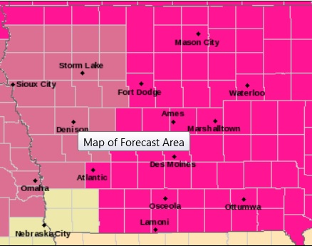
Counties in mauve are included in the Severe Thunderstorm Watch until 1-am Thu.
IOWA COUNTIES INCLUDED ARE AUDUBON BUENA VISTA CALHOUN CARROLL CHEROKEE CLAY CRAWFORD HARRISON IDA MONONA O`BRIEN PALO ALTO PLYMOUTH POCAHONTAS POTTAWATTAMIE SAC SHELBY SIOUX WOODBURY.
* PRIMARY THREATS INCLUDE…
ISOLATED DAMAGING WIND GUSTS TO 70 MPH POSSIBLE
ISOLATED LARGE HAIL EVENTS TO 1.5 INCHES IN DIAMETER POSSIBLE. THE SEVERE THUNDERSTORM WATCH AREA IS APPROXIMATELY ALONG AND 65 STATUTE MILES EAST AND WEST OF A LINE FROM 40 MILES EAST SOUTHEAST OF HILL CITY KANSAS TO 10 MILES NORTHEAST OF SPENCER IOWA.
PRECAUTIONARY/PREPAREDNESS ACTIONS…
REMEMBER…A SEVERE THUNDERSTORM WATCH MEANS CONDITIONS ARE FAVORABLE FOR SEVERE THUNDERSTORMS IN AND CLOSE TO THE WATCH AREA. PERSONS IN THESE AREAS SHOULD BE ON THE LOOKOUT FOR THREATENING WEATHER CONDITIONS AND LISTEN FOR LATER STATEMENTS AND POSSIBLE WARNINGS. SEVERE THUNDERSTORMS CAN AND OCCASIONALLY DO PRODUCE TORNADOES.
AREA COUNTIES: MONONA-HARRISON-SHELBY-POTTAWATTAMIE-MILLS-MONTGOMERY; 1235 PM CDT WED APR 1 2015
…WIND ADVISORY IN EFFECT UNTIL 6 PM CDT THIS EVENING…
THE NATIONAL WEATHER SERVICE IN OMAHA/VALLEY HAS ISSUED A WIND ADVISORY…WHICH IS IN EFFECT UNTIL 6 PM CDT THIS EVENING.
* TIMING…GUSTY SOUTH WINDS WILL PREVAIL THROUGH THE AFTERNOON.
* WINDS…SOUTH WINDS 25 TO 35 MPH WITH GUSTS NEAR 45 MPH.
PRECAUTIONARY/PREPAREDNESS ACTIONS…
A WIND ADVISORY MEANS THAT SUSTAINED WIND SPEEDS BETWEEN 30 TO
39 MPH OR GUSTS BETWEEN 45 TO 57 MPH ARE EXPECTED. WINDS THIS
STRONG CAN MAKE DRIVING DIFFICULT…ESPECIALLY FOR HIGH PROFILE
VEHICLES. USE EXTRA CAUTION.
927 AM CDT WED APR 1 2015
…WIND ADVISORY NOW IN EFFECT FROM 11-AM UNTIL 6 PM CDT THIS EVENING for the following area Counties: SAC-CRAWFORD-CARROLL-GREENE-AUDUBON-GUTHRIE-CASS-and, a RED FLAG WARNING FOR EXTREME FIRE CONDITIONS IS NOW IN EFFECT FROM 11-A.M. UNTIL 7-P.M. for these area Counties: SAC-CRAWFORD-CARROLL-GREENE- AUDUBON-GUTHRIE-DALLAS-CASS-ADAIR-MADISON-ADAMS-UNION-TAYLOR-RINGGOLD. ANY FIRES WILL SPREAD VERY RAPIDLY AND BE VERY DIFFICULT TO CONTROL IN THESE DANGEROUS CONDITIONS. OUTDOOR BURNING IS HIGHLY DISCOURAGED AND SHOULD BE AVOIDED.
* TIMING…WINDS WILL INCREASE STEADILY THIS MORNING AND PERSIST
THROUGH THE AFTERNOON.
* WINDS…SOUTH INCREASING TO NEAR 30 MPH WITH GUSTS OVER 40 MPH
AT TIMES.
* IMPACTS…LOOSE OR UNSECURED OBJECTS WILL GET BLOWN AROUND AND
DRIVING MAY BECOME DIFFICULT AT TIMES. HIGH PROFILE OR LIGHT
WEIGHT VEHICLES WILL BE ESPECIALLY SUSCEPTIBLE TO STRONG
CROSSWINDS.
PRECAUTIONARY/PREPAREDNESS ACTIONS…
A WIND ADVISORY MEANS THAT WINDS OF 35 MPH ARE EXPECTED. WINDS
THIS STRONG CAN MAKE DRIVING DIFFICULT…ESPECIALLY FOR HIGH
PROFILE VEHICLES. USE EXTRA CAUTION.
The Freese-Notis forecast for the KJAN listening area and weather info. for Atlantic.

Podcast: Play in new window | Download (1.7MB)
Subscribe: RSS
TODAY AND TONIGHT…
A RED FLAG WARNING AND WIND ADVISORY IS IN EFFECT. THUNDERSTORMS WILL MOVE INTO THE AREA AROUND SUNSET. SOME MAY BE SEVERE WITH LARGE HAIL AND HIGH WINDS THE PRIMARY THREAT. FOR NOW…IT APPEARS THAT ANY SEVERE STORM DEVELOPMENT WILL PROBABLY BE ISOLATED IN NATURE AND GENERALLY FOUND ALONG AND SOUTH OF INTERSTATE 80.
THURSDAY THROUGH TUESDAY...
PERIODS OF THUNDERSTORMS ARE POSSIBLE FROM LATE SATURDAY NIGHT INTO TUESDAY. THE CHANCE FOR SEVERE STORMS IS LOW.
The just completed month of March was one of the driest in the state’s history. State Climatologist Harry Hillaker says the statewide average precipitation for the month amounted to just under six-tenths of an inch. “This ranked as the seventh driest March in 143 years of records,” Hillaker says. “You have to go back 21 years to 1994 for the last time we had a drier month of March in the state.”
The statewide average temperature for the month was 37.5 degrees, which is slightly warmer than normal. In Atlantic, we received just 32-one hundredths of an inch of rain last month (nearly 1/3 of an inch). The statewide average temperature for the month was 37.5 degrees, which is slightly warmer than normal. The average High here in Atlantic was 56.5 degrees. The average Low was 24.6 degrees.
The month of March featured some interesting temperature extremes. We had temperatures down to minus-17 degrees on March 5 in Stanley in northeast Iowa and up to 90-degrees just 11 days later in Sioux City,” Hillaker says. “That was the earliest we’ve hit 90-degrees in the state…it came on March 16.”
The dry spell will be interrupted across much of the state on this first day of April as showers and severe storms are in the forecast. We’ve actually had 10 consecutive wetter-than-normal Aprils, so we’re certainly getting off to a quick start this April as well,” Hillaker says. The months of January, February and March enter the Iowa record books as 12th driest first three months to the start of a year. “About half of what we’ve had this year came in one storm — the big snowstorm we had January 31 into February 1,” Hillaker says. “Otherwise, it’s been quite dry so far.”
(Radio Iowa)


