
Today: Mostly cloudy. High 38. SE-NW @ 10-20.
Tonight: Mo. Cloudy w/light snow. Low 24. NW @ 5-10.
Tomorrow: Cloudy w/light snow (Up to 1” total, possible). High 31. NW @ 15-25.
Wednesday: Mo. Cldy w/flurries. High 29.
Thursday: Mo. Cldy w/flurries. High 27.
Sunday’s High in Atlantic was 38. Our Low was 11. Last year on this date the High in Atlantic was 43 and the Low was 28. The Record High on this date was 72 in 1897, 1964 & 1990. The Record Low was -5 in 1940.
Today: Partly sunny, with a high near 35. Light south southeast wind increasing to 5 to 10 mph in the morning.
Tonight: Mostly cloudy, with a low around 24. South southeast wind 7 to 9 mph.
Monday: A 30 percent chance of snow after noon. Cloudy, with a high near 36. South wind 3 to 8 mph. Little or no snow accumulation expected.
Monday Night: A 30 percent chance of snow, mainly before midnight. Mostly cloudy, with a low around 20. Calm wind becoming north northwest around 5 mph after midnight. New snow accumulation of less than a half inch possible.
Tuesday: Partly sunny, with a high near 33. Northwest wind 5 to 13 mph.
Tuesday Night: Mostly cloudy, with a low around 15.
Wednesday: Partly sunny, with a high near 29. Blustery.
Yesterday’s high was 30 and the low was 12. This day last year the high was 48 and the low was 28. The all-time record high was 83 set in 1999. The record low was -5 set in 1940. Sunrise this morning is set for 7:06 a.m. and sunset tonight is 5:02 p.m. We picked up a trace of snow flurries during the day, Saturday.
Skyscan Forecast Saturday, November 12, 2022 Dan Hicks
Today: Mostly cloudy this morning, decreasing this afternoon. NW @ 15-20. High 30.
Tonight: Clearing skies. Diminishing winds. Low 8.
Sunday: Partly cloudy. SE @ 5-10. High 36.
Sunday Night: Mostly cloudy. SE @ 5-10. Low 21.
Monday: Mostly cloudy. High 36.
Tuesday. Mostly cloudy. Light snow or flurries. High 34.
Yesterday’s high was 68 and the low was 17. This day last year the high was 33 and the low was 28. The all-time record high was 73 set in 2005. The record low was -4 set in 1968 and again in 2019. Sunrise this morning is set for 7:05 a.m. and sunset tonight is 5:03 p.m. We picked up a trace of snow flurries overnight.
Veterans Day (Today): Partly cloudy. High 32. Winds NW @ 15-25. (Wind chill value around 5 degrees)
Tonight: Fair to Partly cloudy, with a low around 14. NW @ 10-20 diminishing overnight.
Saturday: Partly cloudy. High near 32. NW @ 10-15. Wind chill values as low as 5.
Sunday: P/Cldy. High near 36.
Monday: Mostly cloudy w/a chance of flurries, and a high near 36.
Thursday’s High in Atlantic was 68. Our Low this morning, 18. Last year on this date the High in Atlantic was 52 and the Low was 32. The Record High on this date was 73 in 1964 & 2005. The Record Low was -10 in 1986.
(Radio Iowa/KJAN) -Iowa is undergoing a major weather change. National Weather Service meteorologist Craig Cogil says a cold front will move across the state over the next several hours, taking us from high temperatures mostly in the 60s today (Thursday) to highs only in the 20s and 30s tomorrow. Here in Atlantic, we were in the mid-60’s through 8-a.m., but then the drop-off began, and we were at 57 by 9-a.m. Soon after, the temperature took a nose dive into the mid-40’s.
Cogil says those not yet feeling the chiil, should to enjoy the warmth this afternoon, while it lasts. “As we head towards the afternoon and evening hours, temperatures will be dropping down into the 40s and 30s,” Cogil says. “By tomorrow morning, we’re going to see wind chills in the single digits above zero, so much, much, much colder air.” He adds, once that frigid weather gets here, it’ll likely be sticking around a while.
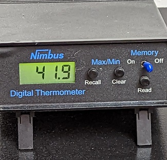
The 10:30-a.m. temp at KJAN in Atlantic (11/10/22)
Cogil says, “Once this cold air arrives, it certainly looks like the next seven to ten days is going to remain below- to much-below normal.” He warns that parts of Iowa could see rain showers and thunderstorms this afternoon, some of which could be severe.
(Radio Iowa) – This is Winter Weather Awareness Day (Thursday) as Iowans are encouraged to start planning for the cold weather that’s coming and brush up on terminology we’ll hear in forecasts for the next several months. Meteorologist Chad Hahn (HON), at the National Weather Service, says some Iowa communities have already had early snows in recent weeks and there’s certainly much more to come. “We know that the season of change is upon us,” Hahn says, “so the more that we can start thinking about it, start to transition our brains from summertime thunderstorm safety and preparedness to wintertime, the better prepared we’ll be.” Hahn says Iowans need to know the difference between a watch and a warning.
“A Winter Storm Watch is when we have the expectations of an event in the offing, and its certainty and the location and specifics aren’t quite clear yet,” Hahn says. “Whenever it gets in the short term, we would upgrade to a Winter Storm Warning. The certainty is there, the details are more clear and we want folks to change plans or make different decisions.” Iowans will also be hearing about Winter Weather Advisories which involve events that motorists should be able to navigate through safely if they simply slow down and make themselves aware of their surroundings.
“The DOT has made it very clear that 75% of crashes occur with events of two inches or less of snow,” Hahn says. “So even though it’s a winter weather advisory, and maybe it’s more of a nuisance level, folks tend to take those less serious and we really want to address that as we go through this winter.” Forecasters say it appears the La Nina weather pattern will continue into the season ahead, for the third winter in a row. “Typically, those conditions would be set up more favorable for colder-than-normal conditions, the tip of the odds towards a colder winter ahead,” Hahn says, “but when we look for precipitation trends from those La Ninas, we don’t see a real good signal across the Midwest here.”
We still have about six weeks of fall ahead, as winter arrives on December 21st.
Today: Mostly Cloudy w/a chance of showers this morning; Temps falling from the 60’s into the 30’s. S- NW winds @ 20-35mph.
Tonight: Cldy to P/Cldy. Low 19. NW @ 10-20.
Veterans Day (Friday): P/Cldy. High 32. NW@ 15-25.
Saturday: P/Cldy. High 32.
Sunday: P/Cldy to cldy. High 36.
Wednesday’s High in Atlantic was 76, which beat the record of 73 set in 1999 for Nov. 9th. Our Low this morning 62. Last year on this date the High in Atlantic was 55 and the Low was 37. The Record High on this date was 76 in 1927. The Record Low was 3 in 1986.
Today: Cloudy to partly cloudy. High 71. S @ 10-20 mph.
Tonight: P/Cldy to Cldy w/a chance of showers late. Low 60. S @ 15-25.
Tomorrow: Mo. Cldy w/showers. High 62. S-NW@ 20-35.
Friday (Veterans Day): P/Cldy & colder. High 32.
Saturday: P/Cldy. High 32.
Tuesday’s High in Atlantic was 63. Our Low was 47. We received just .01″ rain overnight at KJAN. Last year on this date the High in Atlantic was 63 and the Low was 36. The Record High on this date was 73 in 1999. The Record Low was 8 in 1973.
Today: A 30 percent chance of showers, mainly between 9am and 5pm. Mostly cloudy, with a high near 60. Breezy, with a south southeast wind 13 to 17 mph, with gusts as high as 28 mph.
Tonight: A slight chance of showers and thunderstorms before 2am, then a slight chance of showers after 5am. Cloudy, with a steady temperature around 58. Breezy, with a south southeast wind around 16 mph, with gusts as high as 29 mph. Chance of precipitation is 20%.
Wednesday: Mostly cloudy, with a high near 71. Breezy, with a south wind 14 to 20 mph, with gusts as high as 33 mph.
Thursday: A chance of showers and thunderstorms, then showers and possibly a thunderstorm after noon. High near 70. Windy, with a south wind 17 to 21 mph, with gusts as high as 44 mph. Chance of precipitation is 80%. New rainfall amounts between a tenth and quarter of an inch, except higher amounts possible in thunderstorms.
Veterans Day: Partly sunny, with a high near 31. Windy.
Monday’s High in Atlantic was 52. The Low was 32. Last year on this date, the High was 63 and the Low was 33. The Record High on Nov. 8th in Atlantic was 80, in 1999 & 2006. The Record Low was -12, in 1991.
Today: Partly cloudy. High 52. NW winds becoming SE @ 10-15 mph.
Tonight: P/Cldy. Low 34. SE @ 5-10.
Tomorrow: P/Cldy to cloudy. High 58. SE@ 10-20.
Wednesday: P/Cldy to Cldy. High near 70.
Thursday: P/Cldy to Cldy. High 65.
Sunday’s High in Atlantic was 59. Our Low was 24. Last year on this date the High in Atlantic was 69 and the Low was 33. The Record High on this date was 77 in 1915. The Record Low was -14 in 1991.


