
(Radio Iowa) – Wind chill factors are below zero across much of Iowa this (Friday) morning, while forecasters say high temperatures in multiple cities will likely set records this afternoon for being so cold. Meteorologist Mike Fowle, at the National Weather Service, says the high temp in Des Moines won’t even be half of what it should be for this date. “Our current forecast high today is going to be 20 degrees and the previous record low maximum was 24 degrees, and that was set way back in 1881,” Fowle says. “I don’t know how it’s going to make us feel but our average or normal high this time of year should be about 47 degrees, so we’re going to be way below that.” Elsewhere, Ottumwa may only see 23 degrees for a high today. The record low is 24 and the normal high is 48.
In addition to the cold air temperatures, Fowle says those wind gusts will be sharp. “We’re going to see a rather blustery northwest wind today, probably in that 15-to-25-mile-per-hour range. We’re seeing temperatures at a number of locations below zero,” Fowle says. “Not very typical for middle of November, more like mid-January.” Parts of Iowa got more than four inches of snow earlier this week, but there’s no more significant accumulation in the immediate forecast. 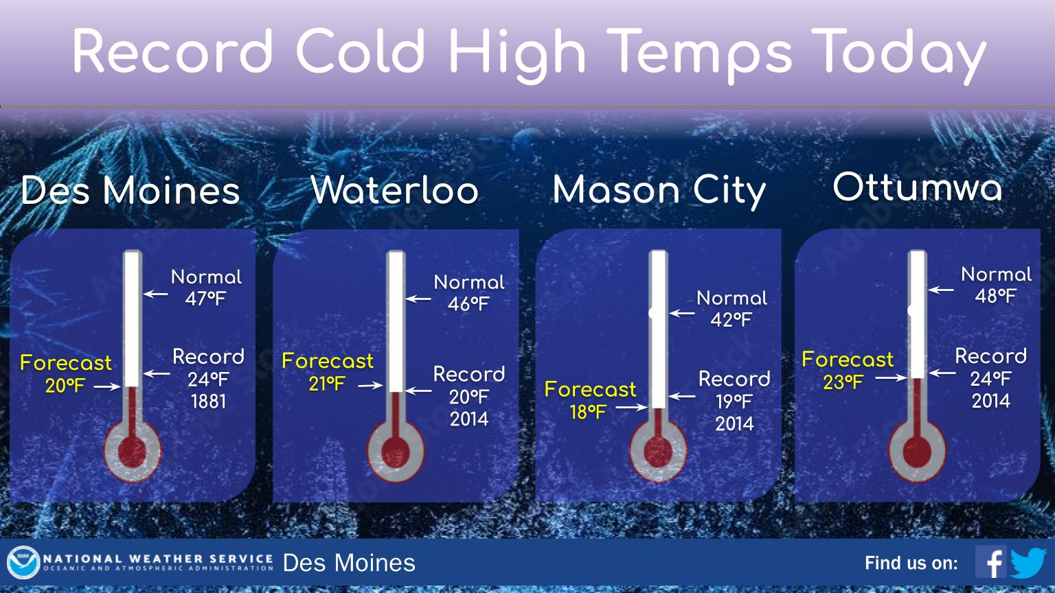
“We’re going to see a continuation of a few flurries and light snow showers as well over the next couple days, but as we get to Sunday and into early next week, we are looking at a warming trend,” Fowle says. “We’re not talking about beach weather or anything like that, but temperatures should be warming back up at least into the 30s and 40s, a little bit closer to the average highs for this time of year.” The extended forecast for next week shows little-to-no snow and highs in the 30s and 40s through Thanksgiving.
Today: Partly cloudy w/flurries possible this morning. High 23. NW @ 15-25.
Tonight: P/Cldy. Low 12. W/SW @ 10-20.
Tomorrow: P/Cldy. High 26. NW @ 15-30.
Sunday: P/Cldy. High 47.
Monday: P/Cldy. High 47.
Thursday’s High in Atlantic was 34. We received a Trace of snow (flurries). Our Low this morning, 12. Last year on this date the High in Atlantic was 39 and the Low was 16. The Record High on this date was 72 in 1999. The Record Low was 0 in 1891.
Today: Partly to Mostly cloudy w/occasional light snow or flurries. High 33. SW-NW @ 15-25.
Tonight: Any snow activity ending; P/Cldy. Low 12. NW @ 10-20.
Tomorrow: P/Cldy. High 24. NW @ 15-25.
Saturday: P/Cldy. High 26.
Sunday: P/Cldy. High near 40.
Wednesday’s High in Atlantic was 27. Our Low was 14. Last year on this date the High in Atlantic was 48 and the Low was 27. The Record High on this date was 73 in 1941. The Record Low was -2 in 1959.
A thin layer of snow has resulted in a few accidents in the area, this morning, but there have been no reports of any injuries. According to 511ia.org, roads mainly east of Highway 173, including Highway 71, a stretch of I-80, Highway 44 and 141, as well as parts of Highway 92, 34 and 2 (to name a few), are partially covered with snow. Slow down, and drive with caution.
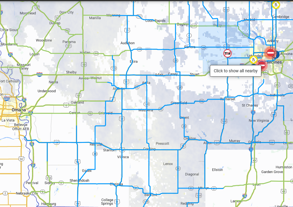
Road report as of 6:40-a.m. 11/16/22 (Click to enlarge)
Today: Mostly cloudy w/light snow or flurries (Trace to a dusting). High 30. NW @ 15-25.
Tonight: P/Cldy to Cldy. Low 18. NW @ 5-10.
Tomorrow: P/Cldy to Cldy. High 32. W-NW @ 15-25.
Friday: P/Cldy. High 24.
Saturday: P/Cldy. High 26.
Tuesday’s High in Atlantic was 32. Our Low this morning, 21. We received .1” of snow Tues. afternoon into early this morning. Last year on this date the High in Atlantic was 70 and the Low was 37. The Record High on this date was 73 in 2001. The Record Low was 1 in 1955.
Today: Mostly cloudy w/scattered flurries High 32. NW @ 15-25.
Tonight: P/Cldy to Cldy w/flurries. Low 20. NW @ 5-10.
Tomorrow: P/Cldy to Cldy w/flurries. High 27. NW @ 15-25.
Thursday: Mo. Cldy w/flurries. High 30.
Friday: P/Cldy. High 24.
Monday’s High in Atlantic was 43. We received 1.2″ of snow in Atlantic overnight, which melted into .12″ liquid value (rain). Our Low was 28. Last year on this date the High in Atlantic was 56 and the Low was 39. The Record High on this date was 75 in 2001. The Record Low was -7 in 1940.
Guthrie-Dallas-Polk-Jasper-Poweshiek-Adair-Madison-Warren-Marion-Mahaska-Adams-Union-Clarke-Lucas-Monroe-Wapello-Taylor-Ringgold– Decatur-Wayne-Appanoose-Davis-
…WINTER WEATHER ADVISORY REMAINS IN EFFECT UNTIL 6 PM CST TUESDAY…
* WHAT…Snow expected. Total snow accumulations of 2 to 5 inches. Locally higher amounts may occur along the Interstate 35 corridor. 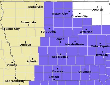
* IMPACTS…Plan on slippery road conditions. The hazardous conditions will impact the morning commute.
PRECAUTIONARY/PREPAREDNESS ACTIONS…
Slow down and use caution while traveling. For the latest travel conditions, check the Iowa 511 app, www.511ia.org, or dial 511.
Guthrie-Dallas-Polk-Jasper-Poweshiek-Adair-Madison-Warren-Marion-Mahaska-Adams-Union-Clarke-Lucas-Monroe-Wapello-Taylor-Ringgold-Decatur-Wayne-Appanoose-Davis Counties…
236 PM CST Mon Nov 14 2022
…WINTER WEATHER ADVISORY IN EFFECT FROM 9 PM THIS EVENING TO 6 PM CST TUESDAY…
* WHAT…Snow expected. Total snow accumulations of 2 to 5 inches. Locally higher amounts may occur along the Interstate 35 corridor.
* IMPACTS…Plan on slippery road conditions. The hazardous conditions will impact the morning commute!
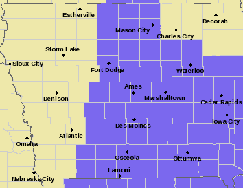
Winter Weather Advisory: Counties in purple/lilac
PRECAUTIONARY/PREPAREDNESS ACTIONS…
Slow down and use caution while traveling.
For the latest travel conditions, check the Iowa 511 app, www.511ia.org, or dial 511.
(Radio Iowa) – There’s still more than a month of fall left but winter weather is moving into Iowa today (Monday). It’s snowing in parts of northwest and north-central Iowa and meteorologist Craig Cogil, at the National Weather Service, says the snow will continue well into the afternoon. “Right now, it looks like the accumulations are mostly going to be in the about the top three tiers or so of Iowa,” Cogil says, “the heaviest right along the border where maybe up to two to three inches of snow are expected today.”
A Winter Weather Advisory is posted for Dickinson, Emmett, Kossuth and Winnebago counties. A second snow storm is forecast to move into Iowa from the south late tonight and move across central Iowa, heading east. “And that snow is going to last on and off until late Tuesday night/early Wednesday,” Cogil says, “and anywhere from one to three inches looks pretty widespread across the eastern two-thirds of the state.” 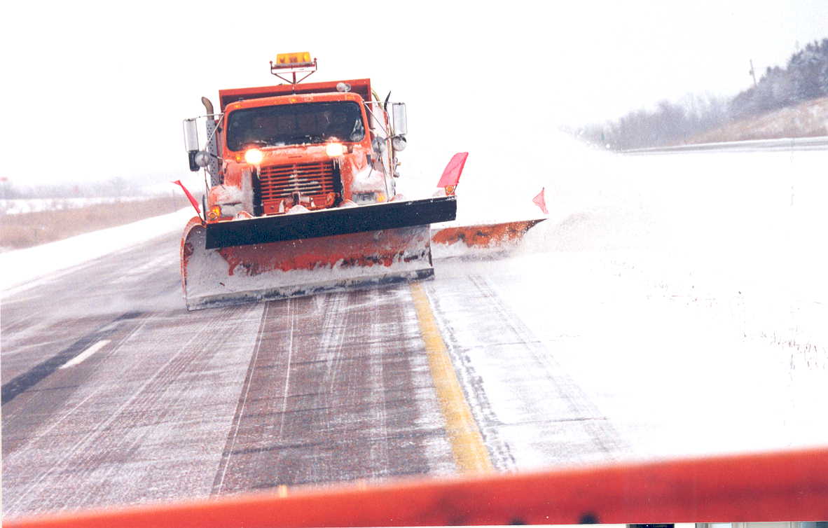
Even though winter doesn’t start until December 21st, Cogil says this second round of snowfall is relatively on target, roughly ten days early. “Typically, I know in the Des Moines area, right around November 25th is the average date of the first inch of snow, so you go north, it’s going to be sooner than that, you head south a little bit later,” Cogil says, “but so it’s not too far off the mark for it really.”
Snow that accumulates will likely be sticking around for several days as he says air temperatures are expected to stay quite cold, and there may not be a warming trend at least until next week.


