
MONONA-HARRISON-POTTAWATTAMIE-MILLS-FREMONT COUNTIES IN IA…HEAT ADVISORY IN EFFECT UNTIL 7 PM CDT THIS EVENING…
THE NATIONAL WEATHER SERVICE IN OMAHA/VALLEY HAS ISSUED A HEAT ADVISORY…WHICH IS IN EFFECT UNTIL 7 PM CDT THIS EVENING.
* TEMPERATURE…TEMPERATURES THIS AFTERNOON WILL PEAK AT 93 TO 100 DEGREES. HEAT INDEX VALUES WILL PEAK AT 105 TO 110 DEGREES.
* IMPACTS…HEAT AND HUMIDITY WILL MAKE HEAT-RELATED ILLNESSES SUCH AS HEAT EXHAUSTION AND HEAT STROKE MORE LIKELY.
PRECAUTIONARY/PREPAREDNESS ACTIONS…
A HEAT ADVISORY MEANS THAT A PERIOD OF HOT TEMPERATURES IS EXPECTED. THE COMBINATION OF HOT TEMPERATURES AND HIGH HUMIDITY WILL COMBINE TO CREATE A SITUATION IN WHICH HEAT ILLNESSES ARE POSSIBLE. DRINK PLENTY OF FLUIDS… STAY IN AN AIR-CONDITIONED ROOM… STAY OUT OF THE SUN AND CHECK UP ON RELATIVES AND NEIGHBORS.
TAKE EXTRA PRECAUTIONS IF YOU WORK OR SPEND TIME OUTSIDE. WHEN POSSIBLE… RESCHEDULE STRENUOUS ACTIVITIES TO EARLY MORNING OR EVENING. KNOW THE SIGNS AND SYMPTOMS OF HEAT EXHAUSTION AND HEAT STROKE. WEAR LIGHT WEIGHT AND LOOSE FITTING CLOTHING WHEN POSSIBLE AND DRINK PLENTY OF WATER.
TO REDUCE RISK DURING OUTDOOR WORK… THE OCCUPATIONAL SAFETY AND HEALTH ADMINISTRATION RECOMMENDS SCHEDULING FREQUENT REST BREAKS IN SHADED OR AIR CONDITIONED ENVIRONMENTS. ANYONE OVERCOME BY HEAT SHOULD BE MOVED TO A COOL AND SHADED LOCATION. HEAT STROKE IS AN EMERGENCY SO CALL 911.
Today: Partly cloudy. High near 90. SE @ 10-15 mph.
Tonight: P/Cldy w/isolated showers possible. Low around 66. SE @ 5-10.
Tomorrow: P/Cldy w/isolated morning showers possible. High 90. SE @ 10-20.
Sunday: P/Cldy. High near 95.
Monday: P/Cldy w/scattered shwrs & tstrms. High near 90.
Thursday’s High in Atlantic was 94. Our 24-hour Low thru 7-a.m. today was 66. Last year on this date, our High in Atlantic was 85 and the low was 60. The All-time Record High in Atlantic on this date was 102 in 1918. The Record Low was 40 in 1974.
Early This Morning: Clear. East wind near 10 mph.
Today: Sunny. High around 90. Southeast wind 5 to 15 mph.
Tonight: Mostly clear. Low in the upper 60s. East wind near 10 mph.
Saturday: Sunny. High around 90. Southeast wind 5 to 10 mph.
Saturday Night: Mostly clear. Low in the upper 60s. Southeast wind 5 to 10 mph.
Sunday: Sunny. High in the mid 90s. South wind 5 to 15 mph with gusts to around 25 mph.
Sunday Night: Partly cloudy. Low in the lower 70s.
Monday: Partly sunny with a 30 percent chance of thunderstorms. High in the upper 80s.
KANSAS CITY, Mo. (AP) – A sweltering heat wave is expanding as temperatures in the Midwest and South approach near record-setting levels in the waning days of spring. The National Weather Service says the number of states under heat advisories nearly doubled Thursday to 12. The affected states are Missouri, Kansas, Texas, Oklahoma, Arkansas, Mississippi, Iowa, Nebraska, Illinois, Louisiana, Kentucky and Tennessee. A Heat Advisory remains in effect from 1-p.m until 7-p.m. today for southwest Iowa (counties along and south of I-80)
Temperatures are forecast in the 90s across much of those states, but the humidity is expected to make them feel much hotter. Heat indexes are expected to hit 115 degrees in central Oklahoma and northeastern Arkansas.
The weather service in Little Rock said on Twitter: “It’s DISGUSTING out there!” In central Kansas’ Salina, the thermometer hit 106 degrees on Wednesday, tying the record for that date. Some relief is expected this weekend as the humidity decreases.
**HEAT ADVISORY from I-80 south, 1-to 7-p.m.**
Today: Clear to P/Cldy, hot & humid. High near 94. Heat Index as high as 102. E/SE @ 5-10 mph.
Tonight: P/Cldy w/isolated thundershowers. Low around 70. SE @ 5-10.
Tomorrow: P/Cldy w/isolated morning showers. High 89. E/SE @ 10-15.
Saturday: P/Cldy. High near 90.
Sunday: P/Cldy. High 95.
Wednesday’s High in Atlantic was 95. Our 24-hour Low thru 7-a.m. today was 64. Last year on this date, our High in Atlantic was 79 and the low was 58. The All-time Record High in Atlantic on this date was 103 in 1946. The Record Low was 42 in 1974.
346 AM CDT THU JUN 16 2016
HEAT ADVISORY IN EFFECT FROM 1 PM THIS AFTERNOON TO 7 PM for counties along and south of Interstate 80 in southwest Iowa.
EARLY THIS MORNING…PARTLY CLOUDY. NORTHEAST WIND 5 TO 10 MPH.
TODAY…SUNNY. HOT AND HUMID. HIGH IN THE MID 90S. EAST WIND 5 TO 10 MPH. HIGHEST HEAT INDEX READINGS 101 TO 106 IN THE AFTERNOON.
TONIGHT…PARTLY CLOUDY UNTIL EARLY MORNING THEN BECOMING MOSTLY CLOUDY. A 20 PERCENT CHANCE OF THUNDERSTORMS OVERNIGHT. LOW IN THE UPPER 60S. EAST WIND 5 TO 10 MPH. HIGHEST HEAT INDEX READINGS 101 TO 106 THROUGH MIDNIGHT.
FRIDAY…MOSTLY SUNNY. A 20 PERCENT CHANCE OF THUNDERSTORMS IN THE MORNING. HIGH IN THE LOWER 90S. SOUTHEAST WIND 5 TO 15 MPH.
SATURDAY…MOSTLY SUNNY. HIGH IN THE LOWER 90S. SOUTHEAST WIND 5 TO 15 MPH.
SUNDAY…SUNNY. HIGH IN THE MID 90S.
CASS-ADAIR-ADAMS-UNION-TAYLOR-RINGGOLD- POTTAWATTAMIE-MILLS-MONTGOMERY-FREMONT-PAGE COUNTIES…
…HEAT ADVISORY IN EFFECT FROM 1 PM TO 7 PM CDT THURSDAY…
* TEMPERATURE…HEAT INDEX VALUES WILL RISE TO 100 TO 105 DEGREES THURSDAY AFTERNOON…DUE TO THE COMBINATION OF HIGHS IN THE MID 90S…WITH DEWPOINTS AROUND 70.
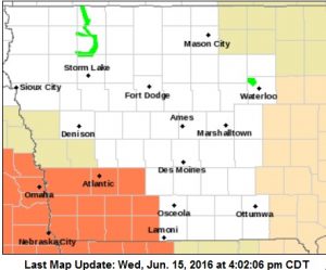
Heat Advisory for counties in orange from 1-to 7-pm Thursday, 6/16
* IMPACTS…HEAT-RELATED ILLNESSES WILL BE MORE LIKELY FOR THOSE SPENDING TIME OUTDOORS THURSDAY.
PRECAUTIONARY/PREPAREDNESS ACTIONS… A HEAT ADVISORY MEANS THAT A PERIOD OF HOT TEMPERATURES IS EXPECTED. THE COMBINATION OF HOT TEMPERATURES AND HIGH HUMIDITY WILL COMBINE TO CREATE A SITUATION IN WHICH HEAT ILLNESSES ARE POSSIBLE.
DRINK PLENTY OF FLUIDS…STAY IN AN AIR-CONDITIONED ROOM…STAY OUT OF THE SUN…AND CHECK UP ON RELATIVES AND NEIGHBORS AND PETS. TAKE EXTRA PRECAUTIONS…IF YOU WORK OR SPEND TIME OUTSIDE. WHEN POSSIBLE…RESCHEDULE STRENUOUS ACTIVITIES TO EARLY MORNING OR EVENING. KNOW THE SIGNS AND SYMPTOMS OF HEAT EXHAUSTION AND HEAT STROKE.
WEAR LIGHT WEIGHT AND LOOSE FITTING CLOTHING WHEN POSSIBLE AND DRINK PLENTY OF WATER. TO REDUCE RISK DURING OUTDOOR WORK…THE OCCUPATIONAL SAFETY AND HEALTH ADMINISTRATION RECOMMENDS SCHEDULING FREQUENT REST BREAKS IN SHADED OR AIR CONDITIONED ENVIRONMENTS. ANYONE OVERCOME BY HEAT SHOULD BE MOVED TO A COOL AND SHADED LOCATION. HEAT STROKE IS AN EMERGENCY…CALL 9 1 1.
Today: Sunny, with a high near 91. West wind 10-15 mph.
Tonight: Clear to P/Cldy. Low around 65. W/NW @ 5-10.
Thursday: P/Cldy. High near 91. Heat index values as high as 100. SE @ 5-10.
Thursday Night: Mostly clear, with a low around 69.
Friday: P/Cldy w/isolated thunderstorms possible. High near 89. SE @ 10-15.
Friday Night: Mostly clear, with a low around 67.
Saturday: P/Cldy. High near 92.
Tuesday’s High in Atlantic was 88. Our 24-hour Low thru 7-a.m. today was 66. We received .02” of rain Tuesday. Last year on this date, our High in Atlantic was 74 and the low was 54. The All-time Record High in Atlantic on this date was 99 in 1918. The Record Low was 40 in 1906 & 1969.
337 AM CDT WED JUN 15 2016
EARLY THIS MORNING…CLEAR. PATCHY FOG. SOUTH WIND NEAR 5 MPH.
TODAY…SUNNY…HOT. HIGH IN THE MID 90S. WEST WIND 5 TO 10 MPH.
TONIGHT…CLEAR. LOW IN THE MID 60S. NORTHWEST WIND NEAR 10 MPH SHIFTING TO THE NORTHEAST AFTER MIDNIGHT.
THURSDAY…SUNNY. HOT AND HUMID. HIGH IN THE MID 90S. SOUTHEAST WIND NEAR 10 MPH. HIGHEST HEAT INDEX READINGS 100 TO 102 IN THE AFTERNOON.
FRIDAY…SUNNY. HIGH IN THE LOWER 90S. SOUTHEAST WIND 5 TO 15 MPH.
SATURDAY…SUNNY. HIGH IN THE LOWER 90S.
Today: Showers and thunderstorms likely, mainly after 5pm. Some of the storms could be severe. Mostly cloudy, with a high near 86. South wind 5 to 10 mph.
Tonight: Showers and thunderstorms likely, mainly before midnight. Some of the storms could be severe. Becoming Partly cloudy. Low around 70.
Wednesday: Partly cloudy. High near 90. West northwest wind 10 to 15 mph.
Wednesday Night: Clear, with a low around 66.
Thursday: P/Cldy. High near 91. East wind 5 to 10 mph.
Friday: P/Cldy w/isolated showers & tstrms possible. High near 91.
Monday’s High in Atlantic was 91. Our 24-hour Low thru 7-a.m. today was 69. We received .12” of rain Monday evening. Last year on this date, our High in Atlantic was 82 and the low was 65. The All-time Record High in Atlantic on this date was 97 in 1987. The Record Low was 41 in 1933.


