
Today: Partly cloudy-to-cloudy w/sprinkles or light rain possible late. High 49. NW-SE @ 10.
Tonight: Mostly cloudy w/light rain. Low 34. S-NW @ 10.
Tomorrow: P/Cldy. High 57. SW @ 10-15.
Thursday: Mo. Cldy w/light rain. High around 50. Friday: P/Cldy to Cldy. High near 40.
Monday’s High in Atlantic was 39. Our Low this morning, 23. Precipitation yesterday amounted to .23″ (including .1″ sleet/snow). Last year on this date, the High in Atlantic was 37 and the Low was 18. The record High for March 10th in Atlantic, was 75 in 2015. The Record Low was -8 in 1948.
Today: Cloudy w/rain ending late. Nearly steady temps in the Low 50’s before slowly falling to around 40 later this afternoon. N @ 10-20. (New precipitation amounts between a quarter and half of an inch possible.)
Tonight: Partly Cloudy to cloudy. Low 25. N @ 5-10.
Tomorrow: P/Cldy to Cldy. Highs around 48. S @ 10.
Wednesday: A chance of showers early; P/Cldy. High near 55. Thursday: Mo. Cldy w/light rain. High near 50.
Sunday’s High in Atlantic was 72. Our Low was 47. As of 6-a.m. today, in Atlantic, we received .11” rain overnight. Last year on this date, the High in Atlantic was 40 and the Low was 24. The record High for March 9th in Atlantic, was 76 in 1986. The Record Low was -10 in 1912.
Today: Sunny, with a high near 69. Windy, with a south wind 16 to 24 mph, with gusts as high as 33 mph.
Tonight: Showers, mainly after 10pm. Low around 41. Breezy, with a south southwest wind 10 to 17 mph, with gusts as high as 24 mph. Chance of precipitation is 100%. New precipitation amounts between a half and three quarters of an inch possible.
Monday: Rain, mainly before 1pm. Temperature falling to around 42 by 5pm. North wind 8 to 15 mph, with gusts as high as 21 mph. Chance of precipitation is 100%. New precipitation amounts between a quarter and half of an inch possible.
Monday Night: A 10 percent chance of rain before 7pm. Partly cloudy, with a low around 28. North northwest wind 5 to 10 mph.
Tuesday: A 20 percent chance of rain after 1pm. Mostly cloudy, with a high near 51. Calm wind becoming south 5 to 8 mph in the afternoon.
Tuesday Night: A 50 percent chance of rain. Mostly cloudy, with a low around 34. New precipitation amounts of less than a tenth of an inch possible.
Wednesday: Mostly sunny, with a high near 55.
Saturday’s High in Atlantic was 69. Our Low, 39. Last year on this date, the High in Atlantic was 40 and the Low was 27. The record High for March 8th in Atlantic, was 76 in 1986. The Record Low was -12 in 1982.
**RED FLAG WARNING for extreme Fire Danger from Noon until 6-p.m. for counties along & south of I-80**
Today: Mostly sunny, warm & windy. High around 68. SW @ 15-30+
Tonight: Fair to Partly cloudy. Low 42. S @ 10-15.
Tomorrow: P/Cldy. High around 68. S @ 10-20.
Monday: Mo. Cldy w/rain. High 47.
Tuesday: P/Cldy to Cldy. High near 50.
Friday’s High in Atlantic was 52. Our Low was 19. Last year on this date, the high was 30 and the low was 19. The Record high in Atlantic on March 7th was 78 in 2000. The Record Low was -11 in 1982.
ATLANTIC, IA — Iowa 3rd District Democrat Representative Cindy Axne, today (Friday), announced a new grant from the U.S. Department of Commerce’s Economic Development Administration (EDA) to facilitate the hiring of a disaster recovery coordinator for flood-affected counties in Southwest Iowa. The $180,000 award goes to help the Southwest Iowa Planning Council (SWIPCO) to establish a coordinator who will implement long-term strategic plans that will assist recovery efforts in counties in southwest Iowa including Fremont, Harrison, and Shelby. According to the EDA, the grant will cover 80% of the costs of establishing and filling the coordinator position.
Rep. Axne says “Securing the funds we need to help with flooding recovery is only one step on the pathway to rebuilding our communities. We need to have professionals in place to make sure our communities are working efficiently and effectively to not just get back to where we were before the floods, but to help us grow beyond them. This new position, part of Department of Commerce’s multi-million dollar investment in Iowa in the aftermath of last spring’s floods, will help us revitalize communities and attract new opportunities.”
The new recovery coordinator will help to create a stable economic climate for business attraction and retention, as well as improving the well-being of the region’s citizens when faced with potential devastating disasters, which will help spur business and social redevelopment in the region. Her office says after securing $3 billion for Midwest flood recovery in last year’s federal disaster bill, Rep. Axne has been tracking these and other grants that are helping Iowa rebuild with her Iowa Flood Funding Tracker.
As of December, the U.S. Department of Commerce reported to Rep. Axne that it has spent $6.6 million on flood recovery efforts in Iowa.
Today: Mostly sunny. High 50. SE @ 5-10.
Tonight: Fair to P/Cldy. Low 32. S @ 5-10.
Tomorrow: Mostly sunny, warm & windy. High 68. SW @ 15-30.
Sunday: P/Cldy. High 68.
Monday: Mostly Cldy & cooler, w/light rain. High 47.
Thursday’s High in Atlantic was 51. Our Low this morning, 21. The High last year on this date was 33, and the Low was -8. The Record High was 76 in 2017. The Record Low was -20 in 1960.
(Radio Iowa) — Warm weather, low humidity and strong winds are making for a foul combination across southern Iowa as the risk of wildfires is rising. In the southwest, Page County Emergency Management Coordinator Kris Grebert says brush fires have been numerous in his area, with two fires just this (Thursday) morning in Shenandoah.
“Within the last week, we’ve had eight or nine grass fires that the different agencies — Clarinda, Shen, Essex, Coin — everybody’s responded to,” Grebert says. “So, they have been relatively busy.” Fortunately, Grebert says the county has avoided structure damage from the fires. “We’ve had pretty good luck with our agencies getting out there pretty quick and not having things get too far out of control,” Grebert says. “The homeowners have called us relatively early on in the process, and we’ve gotten everyone out there and everything put down before they spread too much. We’re just crossing our fingers and hoping nothing bad happens for a while.”
Grebert plans to meet with his counterparts across the county next week. “I have been in contact with each of the fire chiefs from Essex, Shenandoah, Clarinda, Coin and Braddyville to discuss a possible burn ban,” Grebert says. “As of right now, we do not have one on in Page County. We’re hoping some rain will come Monday or Wednesday of next week, then we won’t have to worry so much about it.”
Fremont County’s fire departments are also on guard. Fremont County Emergency Management Coordinator Mike Crecelius says virtually every department was out battling brush fires Wednesday night. Crecelius says conditions are ripe for disaster. “If you have an alleged controlled burn — I always thought that was an oxymoron, because you can’t really control a fire — if it decides to do something, you’re going to lose it,” Crecelius says. “As dry as everything is, once it gets going, it can spread all over all sorts of places out there, because we’ve got a lot of dry ground, we’ve got dry vegetation all over the place.”
Red Flag Warnings are posted for Iowa’s three southern tiers of counties today, virtually everything south of Interstate 80.
Shelby County Emergency Management Coordinator Alexander Londo reports today (Thursday), that the county is “Currently in Extreme Fire Danger,” and Tthere will be no burning allowed until further notice.” The County is under a Wind Advisory until 6-p.m. Gusty winds and low humidities will create a very high risk of grassland fires today. Do not carelessly discard smoking materials, and use extra caution when driving high profile vehicles.
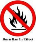
Pottawattamie County is also under a ban on opening burning until further notice.
RED FLAG WARNING in effect south of I-80, from Noon until 6-p.m.**Wind Advisory in effect from 9-a.m. to 6-p.m., north of I-80**
Today: Partly cloudy & windy. High 52. NW @ 20-25 w/higher gusts.
Tonight: Fair to P/Cldy. Low 25. Diminishing NW winds.
Tomorrow: Mostly sunny. High 50. S @ 10.
Saturday: Mo. Sunny. High 68.
Sunday: P/Cldy. High 68.
Wednesday’s High in Atlantic was 59. Our Low was 26. Last year on this date, the High in Atlantic was 24 and the Low was -6. The record High for March 5th in Atlantic, was 74 in 1921. The Record Low was -31 in 1960.
COUNCIL BLUFFS – Pottawattamie County Emergency Management Director Doug Reed, Wednesday afternoon, said an open burning ban was placed into effect for Pottawattamie County, effective at 3-p.m. The ban prohibits all open and controlled burning in
Pottawattamie County, including all incorporated city limits within the county. The ban will remain in place until environmental conditions improve.
 The current dry conditions throughout the region have prompted the National Weather Service to issue Red Flag Warnings. The conditions have also spurred an increase in fire responses throughout the county due to controlled fires quickly becoming uncontrollable. Under the current dry conditions, dead and drying vegetation is the perfect fuel to spread fires rapidly.
Reed said “Pottawattamie County has seen the devastating effects of fire in extreme conditions and we want to do everything we can to help mitigate incidents like that from occurring.” Reed said also, during these dry conditions, citizens are reminded to not throw out cigarettes from moving vehicles and to discontinue burning yard waste, piled tree debris, grass/agricultural ground and set-asides or other items during the ban.
Small recreational camp fires are permitted only if they are conducted in a fire place of brick,
metal or heavy one-inch wire mesh. Any camp fire not in an outdoor fire place is prohibited.
Violation of a burn ban can subject a person to citation or arrest for reckless use of fire or
disobeying a burn ban.
For updated information on burn bans and the law you can find further information on the Pott. County social media and web pages.


