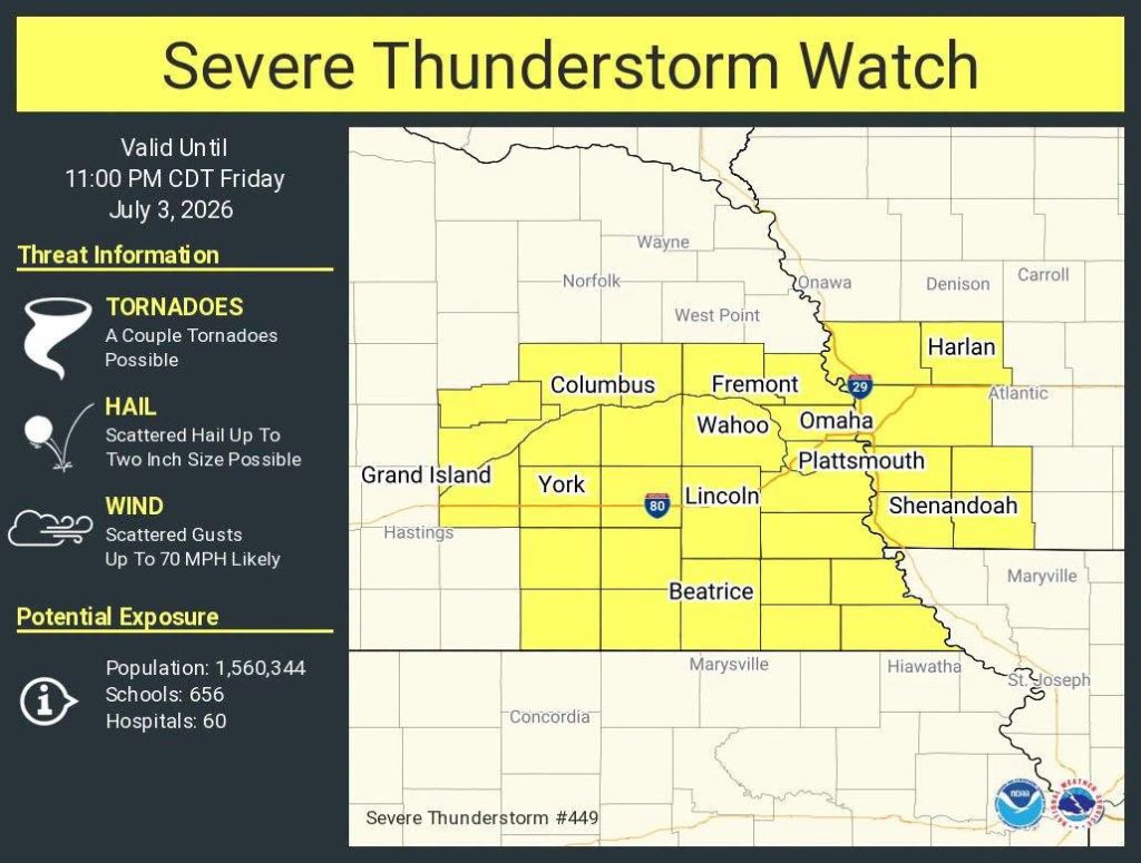
Severe Thunderstorm Watch Number 449
NWS Storm Prediction Center Norman OK
335 PM CDT Fri Jul 3 2026

The NWS Storm Prediction Center has issued a Severe Thunderstorm Watch for portions of Southwest Iowa and     Southeast Nebraska, effective this Friday afternoon and evening from 335 PM until 1100 PM CDT.

   * Primary threats include...
     Scattered damaging wind gusts to 70 mph likely
     Scattered large hail and isolated very large hail events to 2
       inches in diameter possible
     A tornado or two possible

SUMMARY...Thunderstorms will continue to develop across southeast Nebraska in a moist and unstable air mass.  The strongest cells will pose a risk of large hail and damaging wind gusts.

PRECAUTIONARY/PREPAREDNESS ACTIONS...

REMEMBER...A Severe Thunderstorm Watch means conditions are favorable for severe thunderstorms in and close to the watch area.   Persons in these areas should be on the lookout for threatening weather conditions and listen for later statements and possible warnings. Severe thunderstorms can and occasionally do produce  tornadoes.