
403 AM CST MON JAN 6 2014
…WIND CHILL WARNING REMAINS IN EFFECT UNTIL NOON CST TUESDAY FOR ALL BUT EXTREME WESTERN/SW IA (IN MONONA-HARRISON-SHELBY-POTTAWATTAMIE COUNTIES, THE WARNING EXPIRES AT MIDNIGHT TONIGHT. IN MILLS, MONTGOMERY, FREMONT AND PAGE COUNTIES, THE WARNING EXPIRES TONIGHT AT 6 O’CLOCK.)
* SHORT TERM TRENDS…NORTHWEST WINDS OF 20 TO 35 MPH AND HIGHER GUSTS…COMBINED WITH TEMPERATURES 10 TO 20 BELOW ARE CREATING WIND CHILL VALUES FROM 35 TO 50 BELOW ZERO ACROSS THE REGION. THE COLDEST OF THESE READINGS IS OCCURRING OVER NORTHERN IOWA.
* WIND CHILL VALUES…THE MOST EXTREME AND LIFE THREATENING CONDITIONS ARE EXPECTED THROUGH THIS MORNING WITH WIND CHILLS FROM 35 BELOW SOUTH TO 55 BELOW NORTH. OVER CENTRAL IOWA WIND CHILLS WILL DROP TO AROUND 40 TO 45 BELOW.
* IMPACTS…EXTREME WIND CHILLS OF THIS MAGNITUDE CAN RESULT IN FROST BITE IN MINUTES AND LEAD TO HYPOTHERMIA OR DEATH IF PRECAUTIONS ARE NOT TAKEN.
PRECAUTIONARY/PREPAREDNESS ACTIONS...
A WIND CHILL WARNING MEANS THE COMBINATION OF EXTREMELY COLD AIR AND STRONG WINDS WILL CREATE LIFE THREATENING LOW WIND CHILL VALUES. THIS WILL RESULT IN FROST BITE AND LEAD TO HYPOTHERMIA OR DEATH IF PRECAUTIONS ARE NOT TAKEN.
338 AM CST MON JAN 6 2014
…WIND CHILL WARNING IN EFFECT UNTIL NOON CST TUESDAY…
TODAY…MOSTLY SUNNY. BITTERLY COLD. BREEZY. SCATTERED FLURRIES IN THE MORNING. HIGH ZERO TO 5 BELOW. NORTHWEST WIND 15 TO 20 MPH WITH GUSTS TO AROUND 30 MPH. WIND CHILL READINGS 35 BELOW TO 45 BELOW ZERO.
TONIGHT…PARTLY CLOUDY. BITTERLY COLD. LOW AROUND 10 BELOW. WEST WIND 5 TO 15 MPH. GUSTS UP TO 25 MPH THROUGH MIDNIGHT. WIND CHILL READINGS 20 BELOW TO 30 BELOW ZERO.
TUESDAY…PARTLY SUNNY. VERY COLD. HIGH AROUND 15. SOUTHWEST WIND 5 TO 10 MPH. LOWEST WIND CHILL READINGS 15 BELOW TO 25 BELOW ZERO IN THE MORNING.
TUESDAY NIGHT…MOSTLY CLOUDY. NOT AS COLD. LOW 5 TO 10 ABOVE. NORTH WIND NEAR 5 MPH.
WEDNESDAY…CLOUDY. HIGH 15 TO 20. NORTHEAST WIND 5 TO 10 MPH.
WEDNESDAY NIGHT…CLOUDY. LOW ZERO TO 5 ABOVE.
THURSDAY AND THURSDAY NIGHT…MOSTLY CLOUDY. HIGH IN THE LOWER 20S. LOW AROUND 10.
355 PM CST SUN JAN 5 2014
…EXTREME LIFE THREATENING COLD EXPECTED THROUGH TUESDAY MORNING…
THE NATIONAL WEATHER SERVICE IN DES MOINES SAYS AN EXTREMELY COLD ARCTIC AIRMASS WILL CONTINUE TO STRENGTHEN ITS GRIP ON IOWA INTO THE NIGHT AND PERSIST INTO TUESDAY. COMBINED WITH STRONG NORTHWEST WINDS…LIFE THREATENING COLD AND WIND CHILLS WILL OCCUR…ESPECIALLY TONIGHT AND MONDAY.
A WIND CHILL WARNING CONTINUES THROUGH NOON TUESDAY, FOR MOST OF THE STATE OF IOWA.
* SHORT TERM TRENDS…NORTHWEST WINDS OF 15 TO 30 MPH AND HIGHER GUSTS…COMBINED WITH TEMPERATURES IN THE SINGLE DIGITS AND TEENS BELOW ZERO AFTER SUNSET…WILL CREATE WIND CHILL VALUES FROM 25 TO 45 BELOW ZERO BY LATE EVENING. THE COLDEST OF THESE READINGS WILL OCCUR OVER NORTHERN IOWA.
* WIND CHILL VALUES…AN EXTENDED PERIOD WITH EXTREME WIND CHILL VALUES AT LEAST DOWN TO 20 TO 40 BELOW ZERO WILL OCCUR INTO TUESDAY MORNING. THE WORST AND MOST LIFE THREATENING WIND CHILL INDICES ARE EXPECTED EARLY MONDAY MORNING…SEVERAL HOURS EITHER SIDE OF DAYBREAK…WITH WIND CHILLS FROM 35 TO 55 BELOW.
* IMPACTS…EXTREME WIND CHILLS OF THIS MAGNITUDE CAN RESULT IN FROST BITE IN MINUTES AND LEAD TO HYPOTHERMIA OR DEATH IF PRECAUTIONS ARE NOT TAKEN.
PRECAUTIONARY/PREPAREDNESS ACTIONS…
A WIND CHILL WARNING MEANS THE COMBINATION OF EXTREMELY COLD AIR AND STRONG WINDS WILL CREATE LIFE THREATENING LOW WIND CHILL VALUES. THIS WILL RESULT IN FROST BITE AND LEAD TO HYPOTHERMIA OR DEATH IF PRECAUTIONS ARE NOT TAKEN.
329 PM CST SUN JAN 5 2014
…WIND CHILL WARNING IN EFFECT UNTIL NOON CST TUESDAY…
TONIGHT…MOSTLY CLOUDY IN THE EVENING THEN BECOMING PARTLY CLOUDY. BITTERLY COLD. BREEZY. SCATTERED FLURRIES THROUGH MIDNIGHT. LOW 10 TO 15 BELOW. NORTHWEST WIND 20 TO 25 MPH WITH GUSTS TO AROUND 35 MPH. WIND CHILL READINGS 30 BELOW TO 40 BELOW ZERO.
MONDAY...MOSTLY SUNNY. BITTERLY COLD. BREEZY. SCATTERED FLURRIES IN THE MORNING. HIGH ZERO TO 5 BELOW. NORTHWEST WIND 15 TO 20 MPH WITH GUSTS TO AROUND 30 MPH. WIND CHILL READINGS 30 BELOW TO 40 BELOW ZERO.
MONDAY NIGHT...PARTLY CLOUDY. BITTERLY COLD. LOW AROUND 10 BELOW. WEST WIND 5 TO 15 MPH. WIND CHILL READINGS 20 BELOW TO 30 BELOW ZERO.
TUESDAY...PARTLY SUNNY. NOT AS COLD. HIGH AROUND 15. SOUTHWEST WIND 5 TO 10 MPH. LOWEST WIND CHILL READINGS 15 BELOW TO 25 BELOW ZERO IN THE MORNING.
WEDNESDAY…CLOUDY. HIGH 15 TO 20.
THURSDAY…MOSTLY CLOUDY. HIGH IN THE LOWER 20S. Low 10 TO 15.
CASS-ADAIR-MADISON-ADAMS-UNION-TAYLOR AND RINGGOLD COUNTIES…
…WIND CHILL WARNING NOW IN EFFECT FROM NOON TODAY TO NOON CST TUESDAY…
AUDUBON-GUTHRIE AND DALLAS COUNTIES….WIND CHILL WARNING REMAINS IN EFFECT FROM NOW UNTIL NOON CST TUESDAY…
POTTAWATTAMIE COUNTY…WIND CHILL WARNING NOW IN EFFECT FROM 6 PM THIS EVENING TO MIDNIGHT CST MONDAY NIGHT.
MILLS-MONTGOMERY-FREMONT-PAGE COUNTIES….WIND CHILL WARNING REMAINS IN EFFECT FROM 6 PM THIS EVENING TO 6 PM CST MONDAY
MONONA-HARRISON-SHELBY COUNTIES...WIND CHILL WARNING REMAINS IN EFFECT FROM NOON TODAY TO MIDNIGHT CST MONDAY NIGHT.
* TIMING…WIND CHILL VALUES WILL DROP TO NEAR 20 BELOW ZERO BY NOON TODAY THEN DROP TO 30 TO 40 BELOW BY THIS EVENING AS THE COLDER ARCTIC AIR ARRIVES.
* WIND CHILL VALUES…AN EXTENDED PERIOD WITH EXTREME WIND CHILL VALUES OF 20 TO 35 BELOW ZERO WILL OCCUR. LIFE THREATENING WIND CHILL VALUES SUNDAY NIGHT THROUGH MONDAY MORNING OF 35 TO 45 BELOW ARE EXPECTED.
* IMPACTS...EXTREME WIND CHILLS OF THIS MAGNITUDE CAN RESULT IN FROST BITE IN MINUTES AND LEAD TO HYPOTHERMIA OR DEATH IF PRECAUTIONS ARE NOT TAKEN.
PRECAUTIONARY/PREPAREDNESS ACTIONS…
A WIND CHILL WARNING MEANS THE COMBINATION OF EXTREMELY COLD AIR AND STRONG WINDS WILL CREATE LIFE THREATENING LOW WIND CHILL VALUES. THIS WILL RESULT IN FROST BITE AND LEAD TO HYPOTHERMIA OR DEATH IF PRECAUTIONS ARE NOT TAKEN.
Wind Chill Warnings are in effect beginning today through late Mon. evening and Tuesday morning!
Today: Partly sunny and cold, with a high near 4. N-NW winds at 15-30 mph. Wind chill values as low as -25.
Tonight: Mostly Cloudy with scattered flurries after midnight. Low around -14. NW winds at 20-30. Wind chill values as low as -40.
Monday: Partly sunny and cold with scattered flurries before noon. High near -5. NW winds at 15-30 mph. Wind chill values as low as -40.
Monday Night: Partly cloudy, with a low around -11. W-NW winds at 5-15 with gusts to near 20. Wind chill values as low as -30.
Tuesday: Partly sunny, with a high near 13. West southwest wind 5 to 10 mph becoming southeast in the afternoon.
Tuesday Night: Mostly cloudy, with a low around 7.
Wednesday: Cloudy, with a high near 21.
(Update 6-p.m. 1/4/14)
WIND CHILL WARNINGS REMAIN IN EFFECT FOR THE ENTIRE KJAN LISTENING AREA BEGINNING ON SUNDAY. AN ARCTIC AIR MASS WITH BRISK NORTH-TO NORTHWEST WINDS OF 15-25 MPH AND HIGHER GUSTS WILL DROP INTO THE AREA OVERNIGHT AND REMAIN IN PLACE THROUGH LATE MONDAY NIGHT AND TUESDAY. WIND CHILL VALUES WILL FALL TO -20 WITH THE COLDEST AIR IN PLACE SUNDAY NIGHT AND MONDAY. LIFE THREATENING WIND CHILL VALUES OF -35 TO -45 SUNDAY NIGHT THROUGH MONDAY MORNING ARE EXPECTED.
AREA COUNTIES:
CASS-ADAIR-ADAMS-AUDUBON-GUTHRIE-MADISON-TAYLOR AND UNION: WIND CHILL WARNING IN EFFECT FROM 6-AM SUNDAY UNTIL NOON TUESDAY.
MONONA-HARRISON-SHELBY-POTTAWATTAMIE: WIND CHILL WARNING FROM NOON SUNDAY UNTIL MIDNIGHT MONDAY. THE WIND CHILL WATCH IS NO LONGER IN EFFECT.
MILLS-FREMONT AND PAGE: WIND CHILL WARNING IN EFFECT FROM 6-PM SUNDAY UNTIL 6-PM MONDAY.
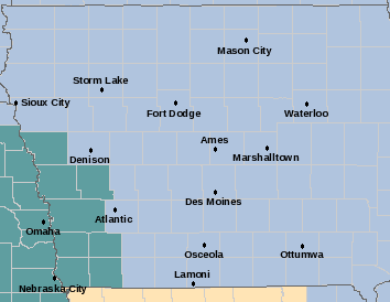
The counties in light blue will be under a Wind Chill Warning beginning at 6-a.m. Sunday. The counties in teal green will be under a Wind Chill Watch beginning Sunday afternoon. (Please see the specific warning and watch information posted under the Weather page on www.kjan.com., or go the National Weather Service website at www.crh.noaa.gov/dmx/)
Today: Patchy blowing snow and a slight chance of snow between 8am and 11am, then patchy blowing snow after 11am. Mostly cloudy, with a temperature falling to around 12 by 5pm. Wind chill values as low as -5. Windy, with a west wind 9 to 14 mph becoming north northwest 18 to 23 mph in the morning. Winds could gust as high as 31 mph. Chance of precipitation is 20%.
Tonight: Mostly cloudy, with a low around -2. Wind chill values as low as -20. Blustery, with a north wind around 16 mph, with gusts as high as 23 mph.
**Wind Chill Warnings and Watches will be in effect beginning on Sunday**
Sunday: Partly sunny and cold, with a high near 1. Wind chill values as low as -25. Windy, with a north northwest wind 15 to 22 mph, with gusts as high as 30 mph.
Sunday Night: Scattered flurries. Mostly cloudy, with a low around -14. Wind chill values as low as -40. Windy, with a northwest wind 20 to 22 mph, with gusts as high as 30 mph.
Monday: Patchy blowing snow and scattered flurries before noon. Partly sunny and cold, with a high near -6. Windy, with a west northwest wind 17 to 21 mph, with gusts as high as 29 mph.
Monday Night: Partly cloudy, with a low around -11.
Tuesday: Partly sunny, with a high near 14.
MONONA-HARRISON-SHELBY and POTTAWATTAMIE Counties: WIND CHILL WATCH REMAINS IN EFFECT FROM SUNDAY AFTERNOON THROUGH MONDAY EVENING.
MILLS-MONTGOMERY-FREMONT and PAGE Counties: WIND CHILL WATCH REMAINS IN EFFECT FROM SUNDAY EVENING THROUGH MONDAY AFTERNOON.
WIND CHILL VALUES…WIND CHILLS WILL REACH AS LOW AS 30 TO 40 DEGREES BELOW ZERO.
* TIMING…ALTHOUGH WIND CHILL VALUES COULD TOUCH 20 BELOW SUNDAY MORNING…A PROLONGED PERIOD OF WIND CHILL VALUES OF 25 BELOW ZERO OR COLDER WILL BEGIN SUNDAY AFTERNOON…REACHING THE COLDEST SUNDAY NIGHT INTO MONDAY MORNING. WIND CHILLS ARE EXPECTED TO REMAIN COLDER THAN 20 BELOW ZERO AT LEAST THROUGH MONDAY EVENING.
PRECAUTIONARY/PREPAREDNESS ACTIONS… A WIND CHILL WATCH MEANS THERE IS THE POTENTIAL FOR A COMBINATION OF VERY COLD AIR AND STRONG WINDS TO CREATE DANGEROUSLY LOW WIND CHILL VALUES. MONITOR THE LATEST FORECASTS AND WARNINGS FOR UPDATES ON THIS SITUATION.


