
Today: Mostly sunny & windy. High near 38. N/NW winds 15-35 mph.
Tonight: Mostly clear, with a low around 23. N/NW winds 5 to 15 mph, with gusts as high as 25 mph.
Tomorrow: Mostly sunny, with a high near 43. N/NW wind around 5-10 in the morning.
Saturday: Mostly sunny, with a high near 49.
Sunday: Mostly cloudy, with a high near 53.
Monday: Mostly sunny, with a high near 35.
Wednesday’s High in Atlantic was 44. Our Low this morning, 27. Last year on this date, the High was 43 and the Low was 18. The Record High in Atlantic on Nov. 21st was 71 in 1990. The Record Low was -14 in 1937. Sunrise: 7:15. Sunset: 4:56.
Today: **WIND ADVISORY from 8-a.m. until 6-p.m.** Increasing clouds. High near 41. W/NW winds 20-45 mph.
Tonight: Partly cloudy & windy. Low around 24. NW winds 15-35 mph.
Thursday: Sunny & windy, with a high near 38. NW winds @ 15-30 mph. .
Friday: Mostly sunny, with a high near 42.
Saturday: Partly sunny, with a high near 48.
Sunday: Mostly cloudy, with a high near 51.
Tuesday’s High in Atlantic was 52. Our Low this morning was 33. Last year on this date, the High was 46 and the Low was 40. The Record High in Atlantic on Nov. 20th was 75 in 1933. The Record Low was -1 in 1937 & 1985. Sunrise: 7:14. Sunset: 4:57.
The National Weather Service in Des Moines reports snow showers and gusty winds will be possible over north central and parts of central Iowa, on Wednesday. Reductions in visibility may occur at times. A few slick areas on roadways could occur near sunset and after. Any accumulations will be light.
There is still uncertainty as to the impacts warm road temperatures will have on potential road conditions. Potential road impacts will increase near to after sunset and may result in wet roadways to freeze. At this time, the primary potential for winter weather is over northern Iowa, there is the potential to extend south into the Des Moines metro.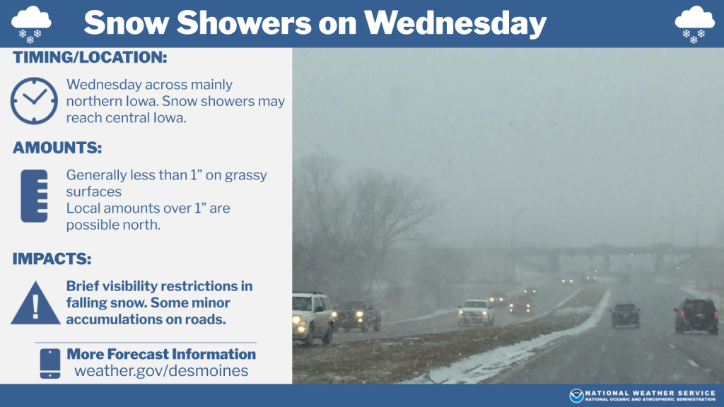
Stay abreast of the latest weather updates on our KJAN Facebook and X social media pages.
Here are some of the OFFICIAL reports to the National Weather Service (from Cooperative Observers), with regard to rainfall that occurred between 7-a.m. Monday and 7-a.m. today (Tuesday).
Atlantic (at KJAN), .78″
Atlantic (7.1 miles N/NE), .85″
Creston (8.3 miles N/NW), .63″
.1 mile S. of Cromwell , .69″
Earling (2.4 mile SE), .86″
Elk Horn (IA) [.2 mile S/SE], .88″
Massena, .85″
Missouri Valley (2.1 miles N/NE), 1.08″
4.7 miles N. of New Market, .62″
Other, UNOFFICAL reports (Public reports to local media)
Anita, .91″
Audubon, .65″
Avoca, .83″
Corning, .77″
Glenwood, .95″
Harlan .95
Red Oak .90
Stanton, 1.0″
Today: Sunny & windy, with a high near 50. Winds West at 15-35 mph.
Tonight: Mostly cloudy & breezy early; Gradually becoming mostly clear, with a low around 29. W @ 10-20 mph.
Tomorrow: Increasing clouds. Windy. High near 41. W/NW winds 15-25 w/gusts to near 40 mph.
Tom. Night: Partly cloudy & blustery, with a low around 23. NW winds 15-30 mph.
Thursday: Mostly sunny & breezy, with a high near 38.
Friday: Mostly sunny, with a high near 42.
Monday’s High in Atlantic was 62. We received .78″ of rain at the KJAN studios, Monday. Our Low this morning, 44. Last year on this date, the High was 59 and the Low was 30. The Record High in Atlantic on Nov. 19th was 73 in 1930. The Record Low was -1 in 1914. Sunrise: 7:13. Sunset: 4:57.
(Radio Iowa) – After a fine fall weekend, forecasters say we’re in for a much colder week ahead with the chance for snow in parts of Iowa midweek. Meteorologist Dylan Dodson, at the National Weather Service, says a storm front will move in later today (Monday) bringing showers, with many areas of the state facing a 100-percent chance of rain. “We’ll see the first signs of that as winds really pick up on the backside of this late tonight into Tuesday morning, and then we’ll also have windy conditions on Wednesday,” Dodson says. “On Wednesday, when those colder temperatures really set in, high temperatures will be getting down into the low 40s to upper 30s, which means our overnight lows are going to be even colder. By the end of the week, we could be seeing widespread lows in the 20s.”
While parts of the Dakotas are expecting more than four inches of snow, Dodson says he doesn’t expect anywhere near those amounts in Iowa, though we may see some flakes flying on Wednesday. “We could see a dusting of snow more likely over the northern portions of the state,” Dodson says. “Not going to be much for accumulations, at least what we’re seeing right now for us, but we could certainly see some snow falling, and then further south and further east, we’ll be seeing more rain or maybe a rain-snow mix.”
The thunderstorms later today could be severe, with strong winds gusting up to 40 miles an hour. Tornadoes are unlikely, but are always possible, even in the final months of the year.) “We’ve had a lot of tornadoes across the state, December 15th, 2021 comes to mind. That had some of the highest tornadoes that we’ve ever seen in the state, and that happened in December,” Dodson says. “Tornadoes can happen any time of the year, so we’ve always got to stay aware. Obviously, the chances get lower when you get into the colder months, but it’s never zero.”
The National Weather Service recently confirmed an E-F-0 tornado hit near Bloomfield on November 5th. That adds to the record year for twisters in Iowa. The state’s now had 125 confirmed tornadoes this year, more than ever before.
Today: Cloudy w/showers & possible thunderstorms this afternoon. High near 61. Winds East @ 15-to 35 mph. New rainfall amounts between 1 and 2 inches possible.
Tonight: Showers and possibly a thunderstorm. Low around 41. SE winds 15-35 becoming Westerly after midnight. New precipitation amounts between a tenth and quarter of an inch, except higher amounts possible in thunderstorms.
Tomorrow: Sunny & windy, with a high near 49. W @ 15-30 mph.
Tom. Night: Partly cloudy & breezy, with a low around 29.
Wednesday: Mostly sunny & windy, with a high near 41.
Thursday: Mostly sunny & breezy, with a high near 39.
Sunday’s High in Atlantic was 54. Our Low was 35. Last year on this date, the High was 65 and the Low was 21. The Record High in Atlantic on Nov. 18th was 72 in 1999. The Record Low was 0 in 1891. Sunrise: 7:12. Sunset: 4:58.
Today: Partly sunny, with a high near 54. North wind around 5 mph.
Tonight: Increasing clouds, with a low around 38.
Tomorrow: Cloudy & windy w/showers. High near 58. East winds 10-20 mph w/gusts to near 35 Monday afternoon. New precipitation amounts between 1 and 2 inches possible.
Tom. Night: Showers and possibly a thunderstorm. Low around 41. SE winds @ 10-20 shifting to the west & gusting to near 30. New precipitation amounts between a quarter and half of an inch possible.
Tuesday: Mostly sunny & windy, with a high near 49.
Tuesday Night: Partly cloudy, with a low around 29.
Wednesday: Partly sunny & windy, with a high near 39.
Saturday’s High in Atlantic was 61. Our Low this morning, was 35. We received .01″ rain Saturday afternoon, in Atlantic (at KJAN). Last year on this date, the High was 52 and the Low was 21. The Record High in Atlantic on Nov. 17th was 73 in 1941. The Record Low was -2 in 1959. Sunrise: 7:11. Sunset: 4:59.
Des Moines, Iowa (Via KCCI and KCRG) — The National Weather Service in Des Moines has confirmed an EF-0 tornado that struck at 11 a.m. on Tuesday, Nov. 5 near the town of Bloomfield. Damage was reported to the National Weather Service and it was determined that a tornado had touched down at 11 a.m. and lasted for around one minute with an overall path length of one-third of a mile. The cell associated with the storm was said to have no lightning. Tornadoes can occur any time of the year.
According to the Weather Service, since January 1st Iowa has broken the record for the most tornadoes touching down in the state in a year, with 122 having been confirmed- and the year isn’t over yet, of course. The previous record was set in 2004. Several different events have contributed to this year’s high number of tornadoes. A Weather Service meteorologist said four of the largest tornadoes occurred April 16th and 26th, and were followed-up by an active weather pattern, in May. Storms on the 21st and 24th of May produced between 18 to 23 tornadoes each.
In addition to a strong jet stream, meteorologists also noted several additional features that helped strengthen storms this year. Dr. Bill Gallus, a professor of Meteorology at ISU told KCRG, “In the spring, the southern part of the United States got very hot, record hot and the Gulf of Mexico warmed up quickly and became warmer than average, which also helps more humidity to enter the atmosphere and then the south winds that came up ahead of these storm systems could bring that higher humidity up to Iowa and that acts as the fuel as the instability for the thunderstorms.”
2024 isn’t the only year we’ve dealt with a high number of tornadoes. In the last 20 years, five years have had more than 100 tornadoes statewide. Scientists don’t think climate change is causing an increase in the number of tornadoes we see. However, experts are considering the possibility that climate change is causing more large scale severe weather events. Officials say learning from this year’s storms will help to prepare for twisters in the years to come.
As for the upcoming Winter months, the Climate Prediction Center – which specializes in long-range, seasonal forecasts – says developing La Niña conditions are expected through the winter. What does that mean for Iowa? The influence of La Niña is most impactful in northern and southern states and along the east coast. Towards the central US, La Niña has less of a signal making it difficult to draw conclusions about what to expect this year. Recent La Niña patterns have generally favored a warmer start to the winter season for our area, followed by colder and snowier conditions over the second half of winter with a later onset of spring.


