
Today: Cloudy with areas of patchy fog. High near 35. N/NW winds 5-10 mph.
Tonight: Cloudy w/patchy fog developing late. Low around 33. Northwest wind around 5 mph.
Tomorrow: Patchy fog before noon. Otherwise, cloudy, with a high near 34. Northwest wind 5-10 mph.
Tom. night: Mostly cloudy, with a low around 25. North northwest wind around 5 mph.
Sunday: Mostly sunny, with a high near 34.
Monday: Mostly sunny, with a high near 40.
Thursday’s High in Atlantic was 36. The Low was 33. We received .15″ of rain. Last year on this date, the High in Atlantic was 36 and the Low was 6. The Record High for Jan. 26th in Atlantic, was 67 in 2002. The Record Low was -24, in 1963. Sunrise today: 7:37. Sunset: 5:28.
Today: **DENSE FOG ADVISORY in effect until Noon** Cloudy w/a 50% chance of rain. Widespread dense fog this morning. High near 35. South southwest wind around 5 mph. New precipitation amounts between a tenth and quarter of an inch possible.
Tonight: Cloudy w/areas of fog & a slight chance of rain. Low around 31.
Tomorrow: Patchy morning fog, otherwise cloudy, with a high near 35. North wind around 5 mph.
Saturday: Mostly cloudy, with a high near 34.
Sunday: Partly sunny, with a high near 34.
Wednesday’s High in Atlantic was 37. The Low was 33. Last year on this date, the High in Atlantic was 29 and the Low was 5. The Record High for Jan. 25th in Atlantic, was 65 in 1944. The Record Low was -28, in 1894. Sunrise today: 7:38. Sunset: 5:27.
(Menlo, Iowa) – Adair/Guthrie County Emergency Management Coordinator Rob Kempf says the 2024 Storm Spotter Class for Adair & Guthrie Counties has been scheduled for March 20, 2024. The class will be held at the Menlo Community Building from 7:00 pm to approximately 9:00 pm. The training will be presented by the Des Moines Office of the National Weather Service and is FREE and open to the public. This training is required every 2 years if you are a registered spotter.
The National Weather Service puts out a call for storm spotters each Spring. Spotter training classes are held through the state. They help those interested in learning about the typical, different modes of weather and what to look for when severe weather is possible. The classes teach your the difference between a shelf cloud and a wall cloud, and what differentiates a scud cloud from a funnel cloud. 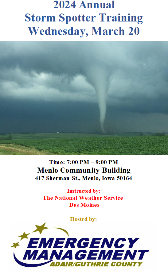
Each class is about two hours long and covers all severe weather hazards including thunderstorms and tornadoes. You’ll have a better understanding of the structure and movement of severe thunderstorms, including identifying storm features and the difference between each. You will also learn important severe weather safety tips. Most classes do not require pre-registration.
Today: Cloudy, with a high near 36. Light and variable wind.
Tonight: A 40 percent chance of rain. Areas of fog before 10pm. Otherwise, cloudy, with a steady temperature around 34. Light south southeast wind. New precipitation amounts of less than a tenth of an inch possible.
Tomorrow: A 40 percent chance of rain, mainly before noon. Cloudy, with a high near 36. Light and variable wind becoming south around 6 mph in the morning. New precipitation amounts of less than a tenth of an inch possible.
Friday: Mostly cloudy, with a high near 35.
Saturday: Mostly cloudy, with a high near 35.
Today: **Winter Weather Advisory for mixed precipitation – until Noon** A chance of rain, snow, and freezing rain, mainly before 11am. Areas of fog. Otherwise, cloudy, with a high near 34. Northeast wind around 6 mph. Chance of precipitation is 40%. Little or no snow accumulation expected.
Tonight: A chance of rain or freezing rain, mainly after 4am. Patchy fog. Otherwise, cloudy, with a low around 32. East northeast wind around 6 mph. Chance of precipitation is 50%. New precipitation amounts of less than a tenth of an inch possible.
Tomorrow: Rain or freezing rain likely before 1pm, then a chance of rain. Patchy fog. Otherwise, cloudy, with a high near 35. Northeast wind 3 to 6 mph. Chance of precipitation is 60%. Little or no ice accumulation expected.
Tom. Night: A 40 percent chance of rain. Cloudy, with a low around 31. Calm wind becoming west southwest around 5 mph. New precipitation amounts of less than a tenth of an inch possible.
Thursday: A 20 percent chance of rain before noon. Cloudy, with a high near 36.
Friday: Cloudy, with a high near 35.
Monday’s High in Atlantic was 33. The Low was 27. We received a dusting of snow overnight into early this morning, at KJAN. Last year on this date, the High in Atlantic was 31 and the Low was 16. The Record High for Jan. 23rd in Atlantic, was 60 in 1981. The Record Low was -24, in 1948. Sunrise today: 7:40. Sunset: 5:24.
Today: Patchy fog after 3pm. Otherwise, cloudy, with a high near 33. Breezy, with a south southwest wind 7 to 16 mph, with gusts as high as 26 mph.
Tonight: A chance of rain, snow, and freezing rain, mainly after midnight. Areas of fog. Otherwise, cloudy, with a low around 31. South wind around 6 mph becoming light and variable. Chance of precipitation is 50%. New snow accumulation of less than a half inch possible. *WINTER WEATHER ADVISORY in effect at midnight for mixed snow/ice**
Tomorrow: A chance of rain, snow, and freezing rain, mainly before 11am. Areas of fog before noon. Otherwise, cloudy, with a high near 34. East northeast wind around 7 mph. Chance of precipitation is 40%. New snow accumulation of less than a half inch possible. **WINTER WEATHER ADVISORY until Noon**
Wednesday: A 50 percent chance of rain. Cloudy, with a high near 35. New precipitation amounts between a tenth and quarter of an inch possible.
Thursday: A 40 percent chance of rain, mainly before noon. Cloudy, with a high near 35.
Sunday’s High in Atlantic was 27 (a 24-hour high). The Low was 6. Last year on this date, the High in Atlantic was 21 and the Low was 13. The Record High for Jan. 22nd in Atlantic, was 60 in 1967. The Record Low was -27, in 1930. Sunrise today: 7:40. Sunset: 5:23.
Today: **Wind Chill Advisory until 11-a.m.**Patchy blowing snow after 10am. Mostly sunny, with a high near 26. Wind chill values as low as -15. Windy, with a south wind 15 to 23 mph, with gusts as high as 33 mph.
Tonight: A slight chance of freezing rain between 2am and 5am. Patchy blowing snow between 8pm and 11pm. Mostly cloudy, with a temperature rising to around 27 by 5am. Wind chill values as low as 5. Breezy, with a south wind 17 to 20 mph, with gusts as high as 30 mph. Chance of precipitation is 20%.
Monday: Cloudy, with a high near 34. Breezy, with a south southwest wind 7 to 16 mph, with gusts as high as 25 mph.
Monday Night: Snow likely, mainly after midnight. Cloudy, with a low around 30. South wind around 6 mph becoming east after midnight. Chance of precipitation is 60%. New snow accumulation of less than one inch possible.
Tuesday: A slight chance of snow, mixing with rain after 9am, then gradually ending. Cloudy, with a high near 35. Chance of precipitation is 20%.
Wednesday: A 40 percent chance of rain. Cloudy, with a high near 35.
Saturday’s High in Atlantic was 6 (24-hour high). The Low was -20. Last year on this date, the High in Atlantic was 32 and the Low was 20. The Record High for Jan. 21st in Atlantic, was 58 in 1935. The Record Low was -32, in 1976. Sunrise today: 7:41. Sunset: 5:21.
Today: Partly sunny and cold, with a high near 5. Wind chill values as low as -20. Blustery, with a west northwest wind 10 to 16 mph, with gusts as high as 25 mph. **Winter Weather Advisory until 6-a.m.**Wind Chill Advisory until Noon**
Tonight: Partly cloudy, with a low around -18. Wind chill values as low as -25. North northwest wind 5 to 10 mph, with gusts as high as 18 mph. **Wind Chill Advisory from 6-p.m. tonight until Noon on Saturday**
Saturday: Sunny and cold, with a high near 0. Wind chill values as low as -30. Light and variable wind becoming west southwest around 6 mph in the morning.
Sunday: Partly sunny, with a high near 25. Windy.
Monday: A 20 percent chance of rain after noon. Cloudy, with a high near 34. Breezy.
Thursday’s High in Atlantic was 22. Snowfall in Atlantic (at KJAN) was 2.7-inches. That melted down to .12″. Our Low this morning was -5. Last year on this date, the High in Atlantic was 32 and the Low was 23. The Record High for Jan. 19th in Atlantic, was 56 in 1895. The Record Low was -38, in 1892. Sunrise today: 7:42. Sunset: 5:19.


