


Plan your fishing trip with the new improved DNR mobile-friendly fishing atlas
May 23rd, 2025 by Ric Hanson
(Iowa Dept. of Natural Resources) – Officials with the Iowa DNR say the popular Iowa online interactive fishing atlas has been updated to include DNR managed lakes, community fishing ponds, hundreds of miles of Iowa rivers including the Mississippi and Missouri rivers, and miles of trout streams. New search features allow anglers to search by waterbody and quickly zoom in to find lake contours, fishing structures, river bends, and trout stream riffles with aerial imagery.
The mobile-friendly atlas will sync with your current GPS location to help you navigate a river segment and find specific lake contours, fish structure locations, and amenities such as fish cleaning stations. DNR Fisheries Biologist Lewis Bruce says “Anglers preferring a paper map can easily create a custom map with the new print tool. You can print a small area of a lake or an entire river segment to identify fish structures in lakes or a trout stream segment.”
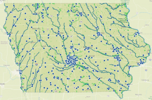
Iowa Fishing Atlas (Screenshot)
Go to https://programs.iowadnr.gov/maps/fishingatlas to plan your next fishing adventure. You can also find the fishing atlas on the free Go Outdoors Iowa App. “Anglers can view the fishing atlas on both desktop computers and mobile devices,” said Lewis. “Making it the perfect tool for every angler throughout all fishing seasons.”

