


NWS backs-down on Essex-Imogene twister width statement
April 20th, 2025 by Ric Hanson
(Omaha, NE) – The National Weather Service has revised an earlier statement, with regard to what was initially described as a record-breaking wide tornado that occurred Thursday evening in parts of Fremont and Page Counties. Officials said two powerful, long-lived supercells tracked across eastern Nebraska and southwest Iowa during the afternoon and evening hours
of April 17. The storms produced widespread damaging hail up to 4 inches in diameter, wind gusts greater than 80 mph, and multiple tornadoes.
Their latest report said “Approximately 8:13 pm on Thursday, April 17, 2025, a tornado formed 3 miles southwest of Tabor. The tornado stirred up copious amounts of dust and dirt from recently plowed agricultural field. The tornado moved southeast across mainly agricultural fields until cross U.S. 275, producing EF-0 damage to roofs and farm outbuildings just south of 130th Street, reaching a width of about 1/4 mile. Based on video, the tornado weakened briefly east of U.S. 275 until it crossed 280th Avenue, where it again reached a width of about 1/4 mile and strengthened again before crossing
290th Avenue, producing EF-0 damage to trees and flipping irrigation pivots. The tornado continued until about the intersection of 300th Avenue and 140th Street where it dissipated.”
With regard to the Fremont-Page County tornado, the Weather Service said that “At approximately 8:32 PM CDT, a tornado formed southeast of Randolph, IA. The first sign of damage was snapped tree limbs near Lake Shawtee WMA (Wildlife Management Area). As the tornado progressed eastward, continued tree damage was observed along with the damage of small outdoor farm buildings and house roofs. A concentrated area of the most extensive damage was observed south of Imogene, IA. 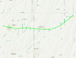

Destroyed outbuilding just north of Essex, west of D Ave.
NWS Damage Survey photo
In this area, damage included snapped wooden power poles, minor damage to homes, and the continued damage of outdoor buildings and trees. The width of damage also reached its peak, approximately 1,971 yards (a little more than 1.1.miles) in this area. The tornado tracked just north of Essex, IA, with more wooden power poles snapped and farm outdoor building damage. After sliding north of Essex, IA, the tornado tracked northeast towards Nyman, IA. Similar damage, including trees, outdoor buildings, and wooden power poles were observed along this stretch. The tornado lifted just east at Nyman, IA at approximately 9:08 PM CDT.
Their previous statement said the tornado near Essex Thursday night was rated as an EF-1, with estimated peak winds of as much as 110 mph, with a maximum width at its peak, of 3,130.6 yards (1.78 miles) (which would have broken a record set in 1950). It was on the ground for nearly 20-miles (19.72).
The track of the twister, its rating and time on the ground did not change in the latest assessment.

