


NWS overview of Friday’s storms across Iowa (Updated)
April 2nd, 2023 by Ric Hanson
(Des Moines, Iowa) – The National Weather Service in Des Moines, in it’s latest report on an intense storm system that tracked across the state of Iowa on Friday, March 31st, says the system pulled unseasonably warm and moist conditions into the Midwest, which coupled with a very favorable wind profile, and created quite the volatile environment for severe thunderstorms. This produced several long lived supercells which developed across central Iowa during the afternoon. The storms were prolific hail producers along with a few reports of wind damage as they moved rapidly northeast. Eventually, the storms produced a few tornadoes before exiting into eastern Iowa.
One of the documented tornadoes began in Wapello County northeast of Ottumwa then tracked northeast into Keokuk County. The primary damage in Wapello County consisted of three homes and one hog confinement facility. The first home lost the entire roof and one external wall. The first failure point was likely the wind entering and lifting the garage which then led to failure of the roof. The home only had straight nailed connections to the external walls spaced
every 18 inches and less to the roof.
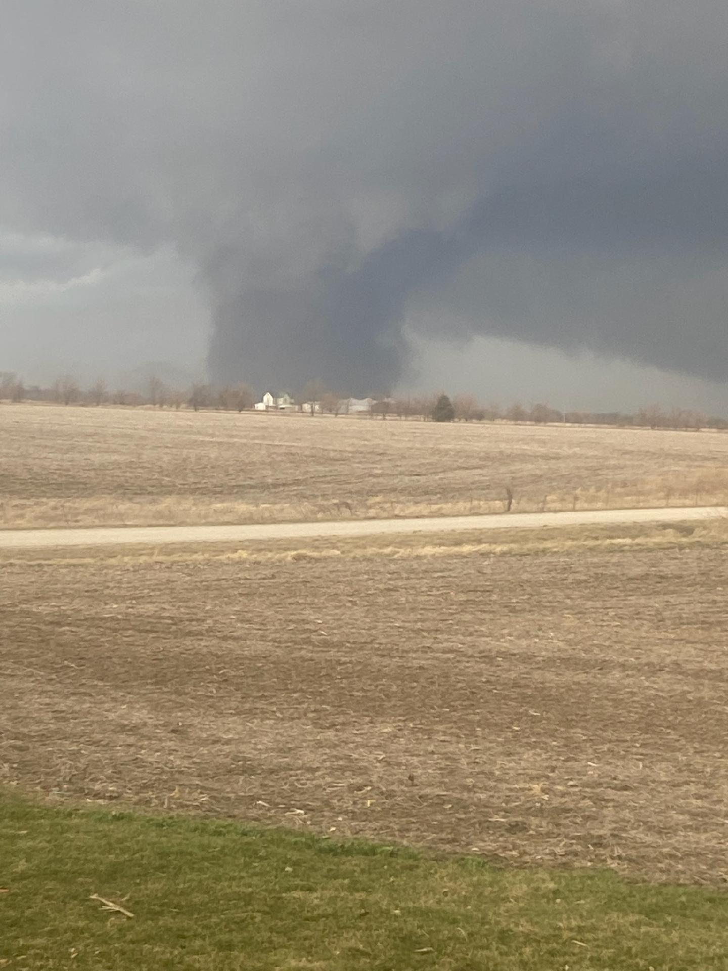
Tornado in northeast Wapello County.
Photo credit: Wapello Sheriff / EM
An unoccupied mobile home on the property was not well anchored and rolled to total destruction. This location was rated 110 mph and EF-1. Two well anchored hog confinement buildings were totally destroyed and were rated EF-2. The tornado then impacted a location with a well built 2 story brick house. The house suffered some roof and window damage
and a loss of a garage door but sustained little other damage. Other damage indicators at the site suggested
EF-1 winds.
Total destruction of a house occurred just prior to the tornado exiting the county. This older house sat unanchored to the concrete block basement. The house was pushed off the foundation and crumbled. Some trees near the house and a propane tank were mostly left with little damage. A larger tree directly next to the house on the wind side had several large limbs removed. Due to all of these reasons, the wind at this location has been rated at 135 mph, or high end EF-2.
The Tornado Path extends into Keokuk County. The National Weather Service in the Quad Cities reports “After collaboration with a team of survey experts, we have determined a prelim. rating of low end EF4 for the tornado that tracked from Wapello into Johnson County IA. Max estimated winds around 170 mph. Max width around 600 yards. There were at least three tornadoes reported by the QC NWS office.

