Drought overview: NWS map shows deficit from 2020-21
August 16th, 2021 by Ric Hanson
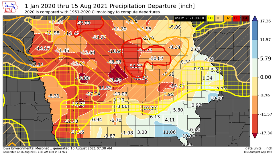
This map created by the National Weather Service in Johnston, shows Precipitation departure from January 2020 to August 15, 2021 with the Drought Monitor overlaid. Is also shows the locations with the most significant precipitation deficit with many locations over northern parts of Iowa ranging from 12 to 18 inches below normal for that aforementioned period.
Notice the northern part of Cass County is down 19 1/4 inches, while the surrounding areas are in a deficit of slightly more than 12.75 inches. Areas in the far west and southwest have recovered slightly, due to recent heavy rain during intense thunderstorms.