


Red Flag Warning until 8-p.m. (3/30) for parts of western Iowa
March 30th, 2021 by Ric Hanson
Monona-Harrison-Shelby-Pottawattamie Counties
1005 AM CDT Tue Mar 30 2021
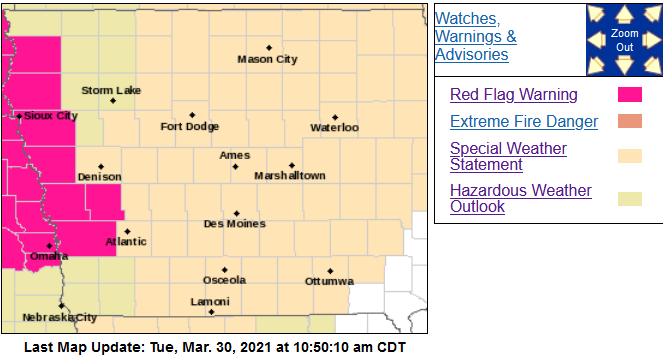 …RED FLAG WARNING IN EFFECT UNTIL 8 PM CDT THIS EVENING FOR WIND AND LOW RELATIVE HUMIDITY…
* Winds…Northwest 20 to 25 mph with gusts up to 35 mph.
* Relative Humidity…As low as 15 percent.
* Impacts…Any fires that ignite may spread rapidly and exhibit extreme fire behavior.
PRECAUTIONARY/PREPAREDNESS ACTIONS…
A Red Flag Warning means that critical fire weather conditions are either occurring now, or will shortly. A combination of strong winds, low relative humidity and warm temperatures can
contribute to extreme fire behavior.
For the rest of the area: Brisk Winds and Elevated Fire Danger Again Today. Although not as windy as Monday, northwest winds will still gust from 25 to 40 mph at times today. It will be cooler as well, but these winds will still combine with drying grasses and low humidities, as low as 25 to 35 percent by afternoon, to produce another day of elevated fire danger.
These winds may blow around unsecured objects and affect high profile vehicles. Also, conditions will be favorable for fires to develop and spread quickly, so avoid outdoor burning.

