


Fire Weather Watch for most of Iowa on Monday
March 28th, 2021 by Ric Hanson
(NWS/Des Moines) – Elevated to Extreme Fire Weather Conditions Possible Monday afternoon Central and South. The combination of warm temperatures, strong wind gusts over 40 mph, lower humidities, and relatively dry grasses and fuels may create elevated to extreme fire weather conditions by Monday afternoon central and south.
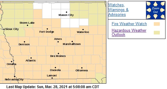 FIRE WEATHER WATCH IN EFFECT FROM MONDAY AFTERNOON THROUGH EARLY MONDAY EVENING FOR EXTREME FIRE CONDITIONS. The National Weather Service in Des Moines has issued a Fire Weather Watch FOR EXTREME FIRE CONDITIONS, which is in effect from Monday afternoon through early Monday evening.
* Relative Humidity…As low as 28 to 32 percent.
* Impacts…Any fires that start Monday afternoon may spread rapidly and become uncontrollable.
* WIND…Strong south to southwest winds with sustained speeds of 25 mph, and gusts of 45 mph possible.
* FUEL…Grasses and any lingering crop debris will dry out quickly in these conditions and may be able to burn easily.
PRECAUTIONARY/PREPAREDNESS ACTIONS…
A Fire Weather Watch means that critical fire weather conditions are forecast to occur. Listen for later forecasts and possible Red Flag Warnings.

