


NWS advises consider rescheduling any travel plans Tuesday into Wednesday: Hazardous travel anticipated
November 24th, 2019 by Ric Hanson
The National Weather Service in Johnston says moderate snow is forecast to develop over portions of west-central to northern Iowa during the afternoon hours Tuesday and continue into early Wednesday morning. The greatest snowfall rates are likely to occur Tuesday evening. A rain/snow line is likely to set up from Waterloo to Des Moines to southwest portions of Iowa.
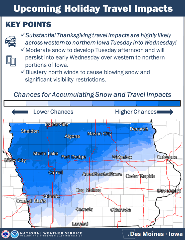
click to enlarge the graphic
Anything northwest of that line is likely to receive the accumulating snow. In addition to the snow, north winds of 25 to 35 mph are likely by Tuesday night and look to persist throughout the day Wednesday resulting in blowing snow and visibility restrictions. Hazardous travel is anticipated due to snow covered and slick roads along with the visibility restrictions.
If traveling Tuesday into Wednesday over portions of western and northern Iowa into Minnesota, please consider rescheduling.

