


Pottawattamie County Anticipating Third Round of Missouri River Flooding
September 14th, 2019 by Ric Hanson
COUNCIL BLUFFS, Iowa – Officials are preparing for the third round of Missouri River flooding in Western Pottawattamie County. Current river forecasts call for a nearly four and a half foot rise in the river over the next week. At these levels, many of the areas that have recently seen some relief could once again find themselves inundated with floodwaters. There is also a very real potential that the Interstates 680 and 29 could once again be impacted by encroaching waters.
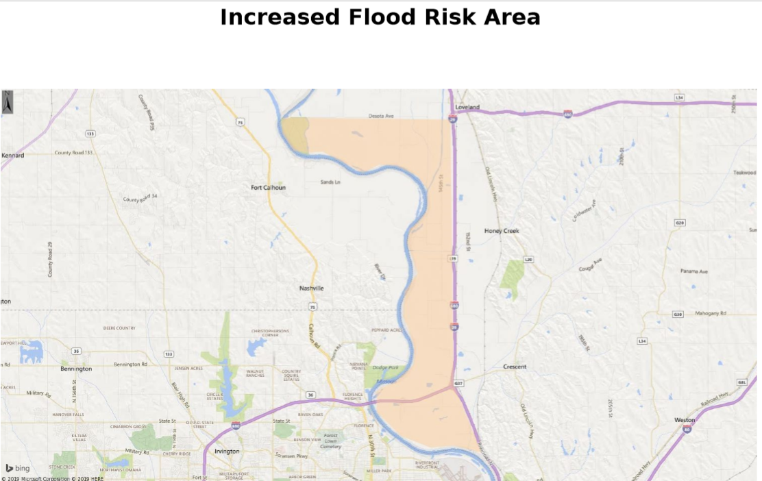
Increased risk flood area (Pott. Co. EMA image) – click to enlarge
In a statement late Friday evening, Doug Reed, emergency management director for Pottawattamie County, said “The time to prepare is now.” Residents in areas that still have ponding water, recently receded water, damaged levees, or damaged drainage ditches should take proactive measures to protect their property and themselves. Reed said, “With the heavy rains experienced north of us, there’s no doubt we will see a significant rise on the river.”
Reed also commented that the Corps of Engineers announced reductions for Gavin’s Point over this weekend in attempt to help reduce the overall crest to try and keep the interstate system open.
Officials urge residents and travelers to remain aware of conditions over the next week, especially the northwest portion of the county. If your house flooded previously then you should assume that it may do so once again. There are many variables that make predicting the flood extent of this event very difficult when you consider that some temporary repairs have been made to levees and drainage ditches, some have not, fluctuating flows from the dam system, and any future rainfalls in the basin.
Residents should pay close attention to local media outlets, the National Weather Service, the Emergency Management 2019 Flood website and emergency management social media platforms to stay aware of updated conditions. Reed said “We urge residents to use the information we provide to make the best decision for their safety and protection of their property.”
Those living in the northwest portion of the county should remain on high alert over the next week and be prepared to leave their homes should it become necessary. If the river forecast is accurate we can expect to lose access to some of our roads which means residents may not be able to leave the area when needed and emergency services will have difficulty and delays getting to them.

