


Excessive rainfall and strong to severe storms expected today over Iowa
October 9th, 2018 by Ric Hanson
The National Weather Service says strong to severe thunderstorms are possible during the afternoon through evening hours today across mostly eastern and parts of southern Iowa, with damaging winds and a few tornadoes are the main threats. Most of these storms should weaken by 11 pm. However, the heavy rain threat will persist through today and tonight before the rain eventually ends on Wednesday morning.
Excessive rainfall is expected in a large swath of the state from Mason City and Decorah southwestward, to the southeast quarter of Fremont County. Cities included in the path of heavy rain include Waterloo, Ames, Marshalltown, Des Moines, Osceola and Lamoni. 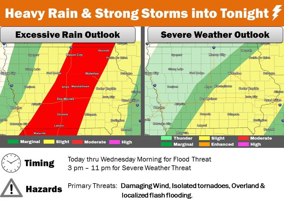
The southeastern half of Cass and Guthrie Counties and all of Adair, Adams, Madison, Union, Taylor and Ringgold Counties, can also expect heavy rain today, causing ponding of water on roads and localized flash flooding along with extensive overland flooding.

