


Strong-to-severe storms possible over parts of southern/s.w. IA this afternoon and tonight
May 14th, 2018 by Ric Hanson
The National Weather Service says strong to potentially severe storms are forecast this afternoon and tonight over central to southern Iowa. The main threats will be large hail and damaging wind. In addition to the severe storms potential, heavy rain is likely to accompany these storms this afternoon and tonight. Generally, a half to an inch of rain is expected with a few isolated higher amounts will be possible by late tonight. Lingering storms are anticipated Tuesday morning. Otherwise, a much welcomed dry period is expected Tuesday night through the end of the work week. There is a low chance for storms Thursday afternoon in western Iowa. The storms are expected to fire-up at around 2-p.m. and last through about midnight. 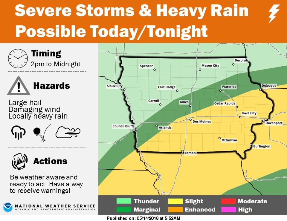
A marginal risk of severe storms is possible in an area that stretches from about Sidney to Council Bluffs, Atlantic northeast to Ames and Waterloo. A Slight risk exists south and east of that line, with mainly thunder over the remainder of western, northwest, north central and northeast Iowa.
