


Heavy rain possible mid-week, colder temps by Friday
May 6th, 2019 by Ric Hanson
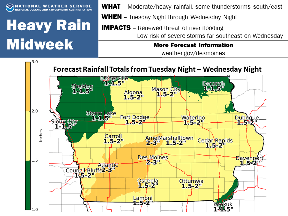
(Click on the map to enlarge)
It will be cool and wet for the next several days. The National Weather Service in Des Moines reports scattered showers are forecast from today into Tuesday, then widespread moderate to heavy rainfall is expected between Tuesday night and Wednesday night. Anywhere from two- to three-inches is possible from the Ames-Marshalltown area southwest, through Atlantic and into the southwest corner of the State.
Severe weather is unlikely, with just a low chance for a few severe storms in far southeast Iowa on Wednesday afternoon and evening. However the heavy rainfall totals may lead to renewed river flooding concerns in some areas and will make for a very soggy period around midweek. The rain will finally clear out on Thursday, followed by several days of generally quiet but unseasonably cool weather. Thursday in particular will be cold and raw, with high temperatures only in the 50s and northwest winds around 15-20 mph along with a few lingering sprinkles. By Friday morning temperatures will fall into the mid to upper 30s in parts of northern and western Iowa.

