


Expect issues with travel this weekend as snow, wind & cold air impact the area
January 2nd, 2015 by Ric Hanson
The National Weather Service in Des Moines reports significant travel concerns are expected Saturday evening into Sunday morning over much of central Iowa. A two part system, with the first looking to pass over Missouri overnight tonight into Saturday will provide the potential for a wintry mix over south-central to southeast Iowa Saturday morning. The second and stronger piece of energy will bring the main snow band across central Iowa late Saturday afternoon and into Saturday evening.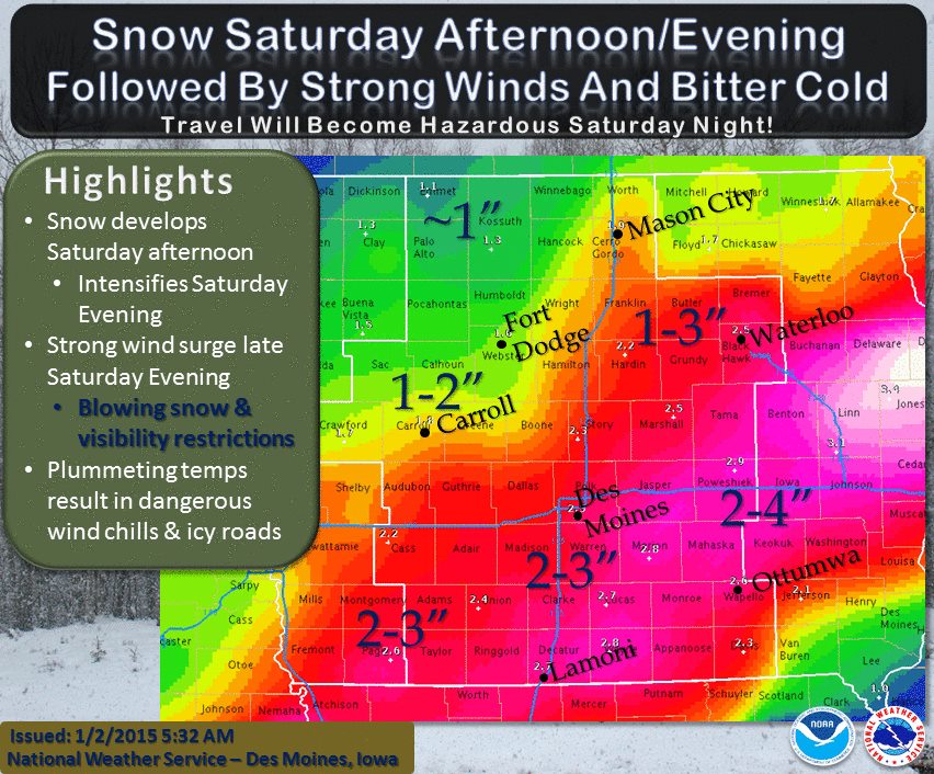
With the sharp cold front Saturday evening, strong northwest winds combined with falling snow will likely lead to areas of blowing snow and visibility restrictions late Saturday evening into Sunday morning. Temperatures are forecast to quickly plummet with the strong push of cold air Saturday night and may result in roads becoming icy and causing significant travel concerns. Generally 1 to 4 inches of snow is forecast over central Iowa by late Saturday night with the higher amounts along and south of Interstate 80 and east of Interstate 35.
Again, the snow amounts are not the major concern, it is the falling snow coupled with the very strong winds Saturday night into Sunday morning. Bitter cold temperatures and wind chills are expected all day Sunday into Sunday night and the cold will persist through much of the work week. Another clipper system looks to bring accumulating light snow to northern Iowa Monday night into Tuesday.

