


(Updated) Severe Weather Chances increasing across much of western IA
June 16th, 2014 by Ric Hanson
The latest weather statement from the National Weather Service points to an ever-increasing risk for severe thunderstorms across Iowa, today. Scattered thunderstorms may be moving northeast out of Nebraska into western Iowa and may contain large hail over an inch in diameter. More vigorous activity is expected to develop by mid to late afternoon over northwest Iowa then shift east into this evening.
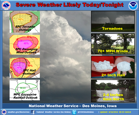
The latest outlook shows an increased risk for damaging winds and large hail.
Very strong storms are expected with this activity. Initial storms may produce very large hail and a few tornadoes before evolving into a damaging wind threat by mid to late evening. Heavy rainfall is possible as well, especially over northern Iowa. Localized flash flooding may occur with storms producing intense rainfall rates.
(Updated 9:45-a.m.)

