


Election day/night storms across the Midwest
June 3rd, 2014 by Ric Hanson
Strong to severe thunderstorms are forecast to develop late this (Tuesday) afternoon across far western Iowa and will quickly transition eastward this evening. The storms will have the potential to produce damaging winds in excess of 70 mph, large hail, and isolated rain wrapped tornadoes. The severe threat looks to continue through the late evening hours.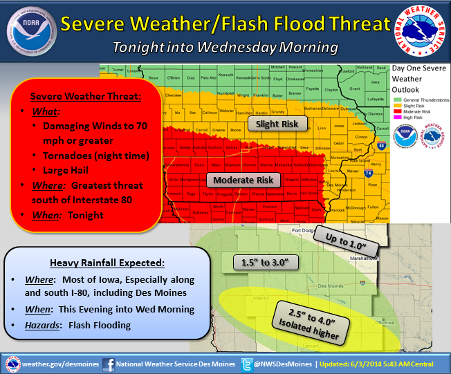
In addition to the severe weather threat, very heavy rain will accompany these thunderstorms. Rainfall rates of 3 to 5 inches per hour are possible along and south of Interstate 80. This is likely to lead to areas of flash flooding where rainfall totals of 2 to 4 inches will be common, with some areas receiving over 5 inches by Wednesday morning. A Flash Flood Watch in is in effect this evening into Wednesday morning across the southern half of Iowa.
