


Severe weather possible again today (Friday)
October 4th, 2013 by Ric Hanson
The National Weather Service says a moderate risk for severe weather is in place across northern Iowa this afternoon and evening while a slight risk encompasses much of the remainder of the state. Scattered thunderstorms will linger across the area this morning. An isolated severe storm with quarter sized hail and 60 mph winds are possible with this activity. A line of strong to severe storms is expected to develop over western Iowa by this afternoon.
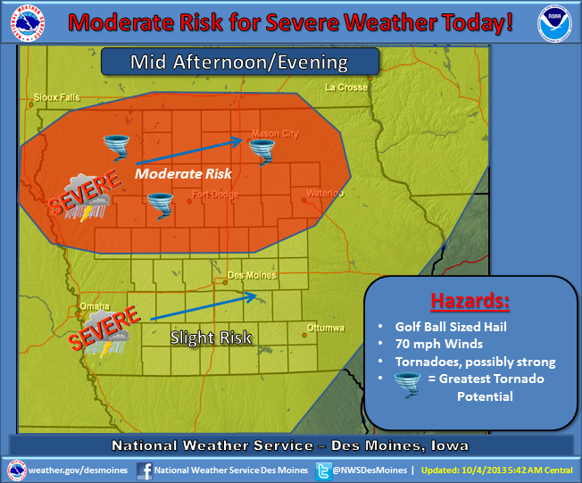
(Graphic) – NWS Severe Weather potential.
That activity will race northeast and into the area from late afternoon through mid-evening. Very large hail, damaging winds and a few tornadoes are likely, especially over the moderate risk region. A few severe storms with a heightened risk for damaging winds are likely over central and northern Iowa along with an attendant large hail and isolated tornado threat. This could become a potentially dangerous situation.
Be prepared to take appropriate actions if severe weather approaches your location. The storms will begin to weaken after midnight. By Saturday, a strong cold front will be passing through the area, ushering in much colder temperatures. Thunderstorm chances will pass to the east with dry and windy conditions in place by the afternoon.

