
THE NATIONAL WEATHER SERVICE HAS ISSUED SEVERE THUNDERSTORM WATCH 473 IN EFFECT UNTIL MIDNIGHT CDT TONIGHT FOR THE FOLLOWING AREA COUNTIES:
AUDUBON CARROLL CASS CRAWFORD DALLAS GUTHRIE HARRISON MILLS MONONA POTTAWATTAMIE SAC AND SHELBY.
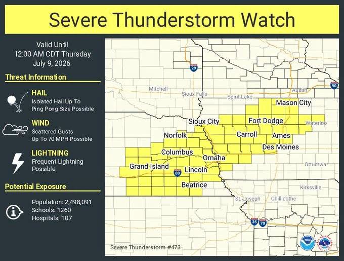
   * Primary threats include...
     Scattered damaging wind gusts to 70 mph possible
     Isolated large hail events to 1.5 inches in diameter possible

   SUMMARY...Scattered thunderstorms are expected from northern Iowa
   into eastern Nebraska through late evening, with a mix of multicell
   clusters and transient supercells.  Damaging gusts of 60-70 mph will
   be the main threat, though the stronger storms could produce
   isolated large hail of 1-1.5 inches in diameter.
   PRECAUTIONARY/PREPAREDNESS ACTIONS...

   REMEMBER...A Severe Thunderstorm Watch means conditions are
   favorable for severe thunderstorms in and close to the watch area.
   Persons in these areas should be on the lookout for threatening
   weather conditions and listen for later statements and possible
   warnings. Severe thunderstorms can and occasionally do produce
   tornadoes.