
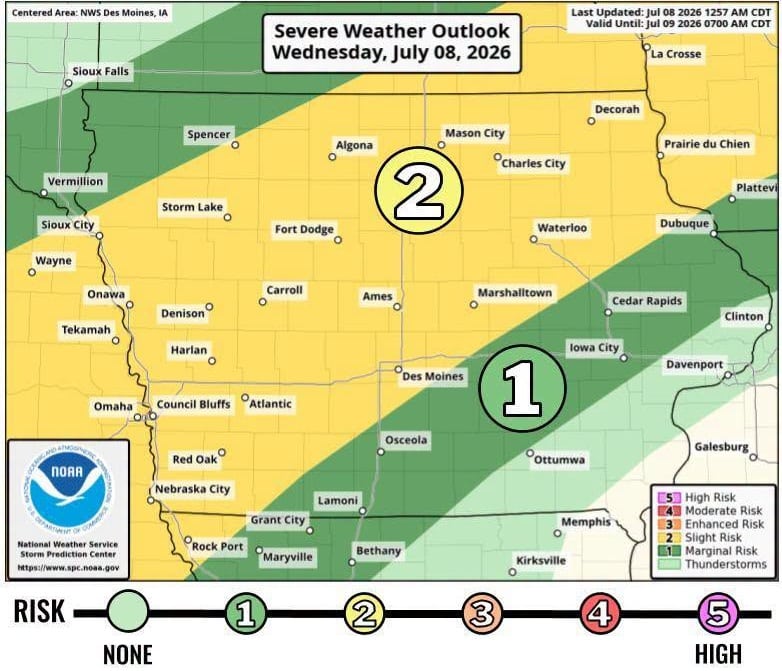
(Radio Iowa) – Extremely hot weather is creeping back into Iowa’s forecast for early next week, but the more immediate threat is the possibility of severe storms this afternoon. Meteorologist Ashley Bury, at the National Weather Service, says the highest risk is to parts of western, north-central and northeastern Iowa.
“We’re going to see increasing chances for showers and thunderstorms into the afternoon and evening, and with that comes the potential for severe weather,” Bury says. “Damaging winds and heavy rainfall look like the primary threats, but there could be a lower potential for a tornado or two and some hail with that.”
Bury says the forecast indicates temperatures will be getting steamy again soon. “Really Sunday and into early next week, we’re going to start seeing temperatures generally in the 90s again,” she says. “It’s definitely warming back up and it’s important to practice those safety tips for staying cool during these warmer times.”
Those tips include wearing light-weight and light-colored clothing, taking frequent breaks if you’re working outside, and drinking plenty of water.