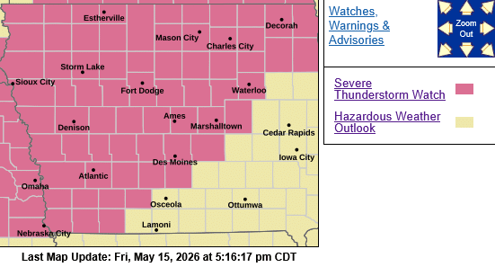
The NWS Storm Prediction Center has issued a Severe Thunderstorm Watch for portions of Western into Central and Northern Iowa, effective this Friday afternoon and Saturday morning from 515 PM until 100 AM CDT.

   * Primary threats include...
     Scattered damaging winds and isolated significant gusts to 80 mph likely
     Scattered large hail and isolated very large hail events to 3.5 inches in diameter likely
     A tornado or two possible

SUMMARY...Thunderstorms are forecast to develop and intensify early this evening.  Supercells capable of very large hail are expected initially (diameters between 2.5 to 3.5 inches).  A tornado or two is possible later this evening.  Upscale growth into one or two bands or bowing segments is expected later this evening with severe   wind gusts becoming more prevalent.  Peak gusts associated with the thunderstorm bands will probably range 70-80 mph.

PRECAUTIONARY/PREPAREDNESS ACTIONS...

REMEMBER...A Severe Thunderstorm Watch means conditions are favorable for severe thunderstorms in and close to the watch area. Persons in these areas should be on the lookout for threatening weather conditions and listen for later statements and possible warnings. Severe thunderstorms can and occasionally do produce  tornadoes.