The Des Moines National Weather Service has produced an updated weather briefing concerning the heavy rain and severe weather potential.
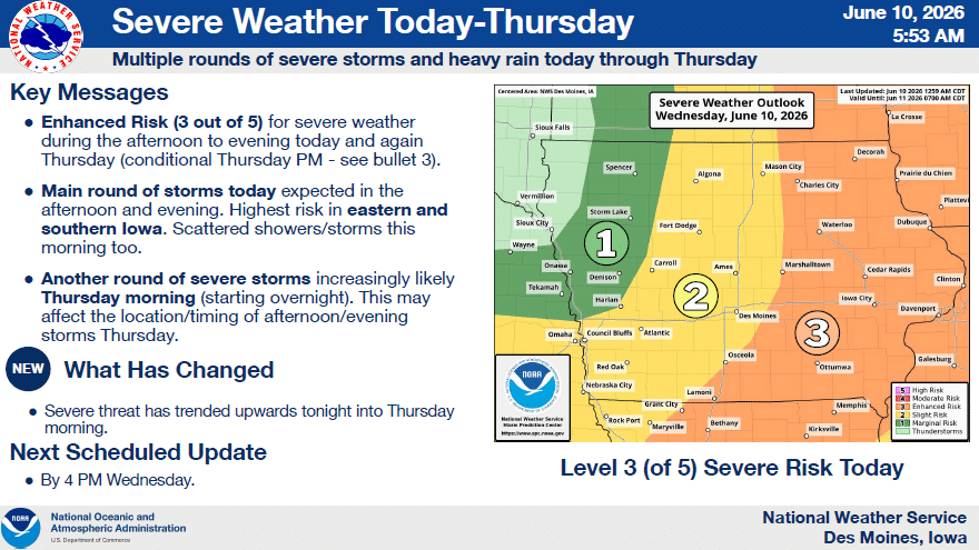
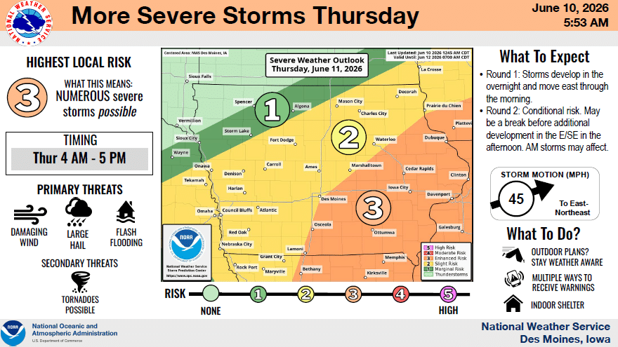
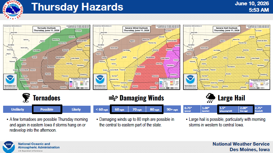
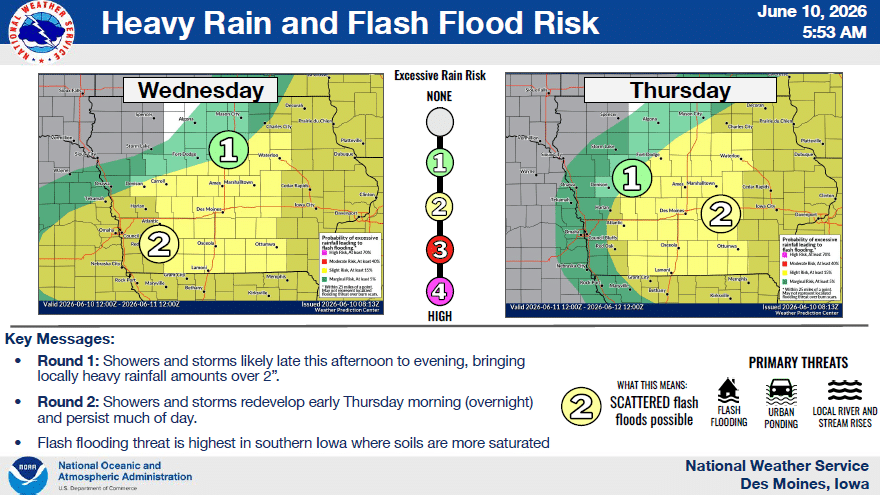
- WHAT – Multiple rounds of severe thunderstorms and heavy rainfall.
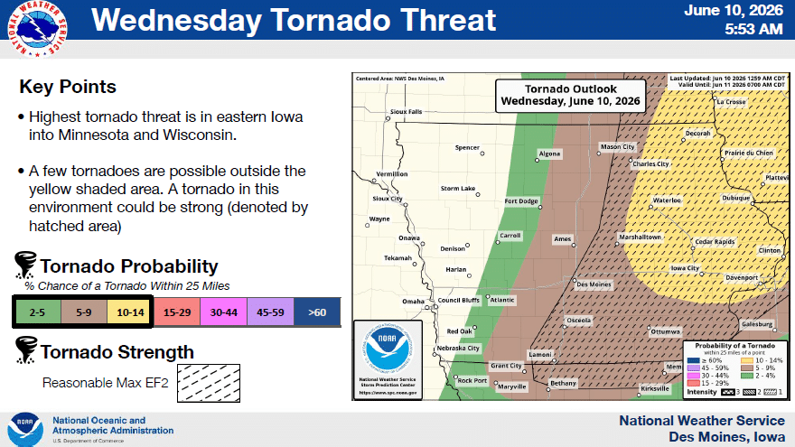
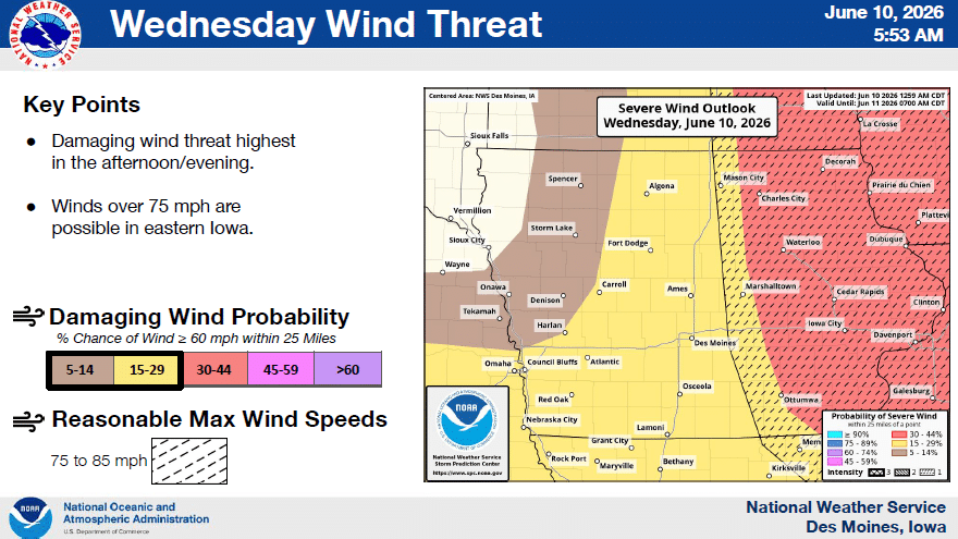
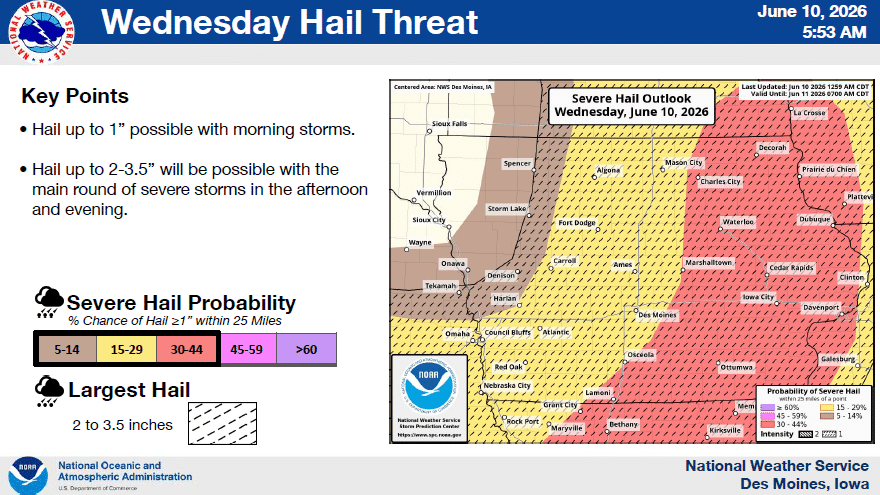
- WHERE – Severe weather and heavy rainfall chances over much of the area, highest in eastern and southern Iowa.
- WHEN – Shower and storm chances from this morning through Thursday afternoon. Best windows for severe storms are between 3-11pm today, and 4AM and 5 PM on Thursday (may be a break between rounds Thursday late morning/early afternoon)
The briefing is available at https://www.weather.gov/media/dmx/DssPacket.pdf Additional severe storm specific information at https://www.weather.gov/dmx/dsssevere The next email briefing is scheduled to be sent by around 4 PM today (Wednesday).