(5:45-p.m. 6/5/26) – A severe thunderstorm watch has been issued for parts of Iowa, Kansas, Missouri and Nebraska until 12 AM CDT
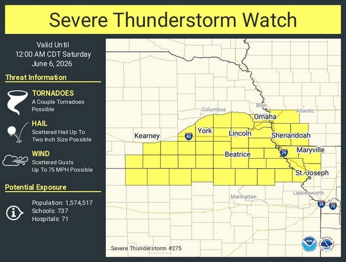
IOWA COUNTIES INCLUDED ARE: FREMONT; MILLS; MONTGOMERY; PAGE and POTTAWATTAMIE.
   * Primary threats include...
     Scattered damaging winds and isolated significant gusts to 75-mph possible
     Scattered large hail and isolated very large hail events to 2-inches in diameter possible
     A tornado or two possible

SUMMARY...Thunderstorms should continue to develop this evening along/near the Kansas/Nebraska border. The strongest thunderstorms should pose a threat for large to very large hail (up to 2 inches in diameter) and severe/damaging winds (up to 65-75 mph). A tornado or two is also possible along/near a stationary front.

PRECAUTIONARY/PREPAREDNESS ACTIONS...

REMEMBER...A Severe Thunderstorm Watch means conditions are favorable for severe thunderstorms in and close to the watch area. Persons in these areas should be on the lookout for threatening weather conditions and listen for later statements and possible warnings. Severe thunderstorms can and occasionally do produce  tornadoes.