
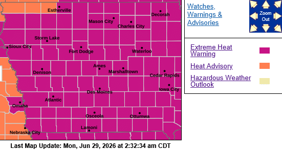
**EXTREME HEAT WARNING continues until 9-p.m. Tuesday**
Today: Sunny, hot & windy. A high near 94. Heat index values as high as 106. Winds South @ 15-35 mph.
Tonight: Increasing clouds. A 20% chance of showers & thunderstorms late. Low around 75. Winds S @ 15-35 decreasing to around 10-15 mph after midnight.
Tuesday: Mostly sunny. A high near 94. Heat index values as high as 101. Winds S/SW @ 10-25 mph.
Tue. Night: A 40% chance of showers & thunderstorms. Low around 75.
Wednesday: Mostly sunny & windy, with a high near 92.
Wed. Night: A slight chance of showers or thunderstorms. Low around 75.
Thursday: Mostly sunny & breezy, w/a slight chance of showers & thunderstorms. A high near 91.
Sunday’s High in Atlantic was 92. The Low was 76. Last year on this date, the High in Atlantic was 85 and the Low was 66. The Record High in Atlantic for June 29th, was 102 in 1934, and the Record Low was 46 in 1950. Sunrise: 5:48; Sunset: 8:58.
…EXTREME HEAT WARNING REMAINS IN EFFECT UNTIL 9 PM CDT TUESDAY…
* WHAT…Dangerously hot conditions with heat index values above 100 expected.
* IMPACTS…Heat related illnesses increase significantly during extreme heat and high humidity events.
* ADDITIONAL DETAILS…Extreme heat will persist through much of next week, potentially including the 4th of July weekend.
PRECAUTIONARY/PREPAREDNESS ACTIONS…
Drink plenty of fluids, stay in an air-conditioned room, stay out of the sun, and check up on relatives and neighbors. Take extra precautions when outside. Wear lightweight and loose fitting clothing. Try to limit strenuous activities to early morning or evening. Take action when you see symptoms of heat exhaustion and heat stroke.

