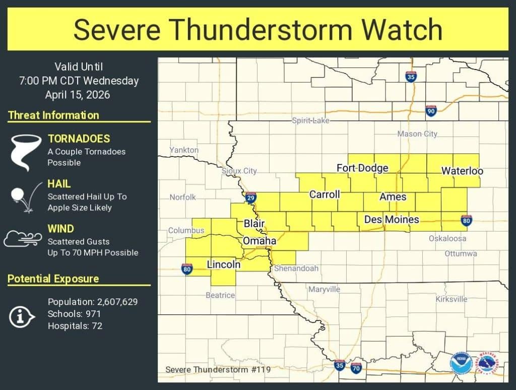
1230 PM CDT Wed Apr 15 2026
The NWS Storm Prediction Center has issued a Severe Thunderstorm Watch # 119 for portions of Western and Central Iowa, and Eastern Nebraska, effective this Wednesday afternoon and evening from 1230 PM until 700 PM CDT.
* Primary threats include…
Scattered large hail and isolated very large hail events to 3 inches in diameter likely
Scattered damaging wind gusts to 70 mph possible
A tornado or two possible
SUMMARY…Mainly elevated supercells along and north of a surface front should pose a threat for large to very large hail as they move quickly east-northeastward this afternoon, with peak hail size up to 2-3 inches in diameter. Occasional damaging winds may also occur.
PRECAUTIONARY/PREPAREDNESS ACTIONS…
REMEMBER…A Severe Thunderstorm Watch means conditions are favorable for severe thunderstorms in and close to the watch area. Persons in these areas should be on the lookout for threatening weather conditions and listen for later statements and possible warnings. Severe thunderstorms can and occasionally do produce tornadoes.