
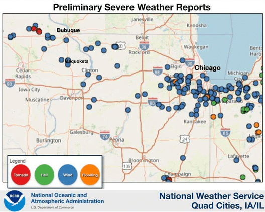
(Radio Iowa) – The Storm Prediction Center of the National Weather Service confirms it was a derecho that blasted across eastern Iowa on Tuesday morning. The powerful storm continued into Illinois and Indiana, where winds topped off at 99 miles an hour. Damage in Iowa is still being assessed, though it’s reported Clinton and Jackson counties were hardest hit, including near the town of Maquoketa. Also, three E-F-1 tornadoes are confirmed during the storm, all in Delaware County. Meteorologist Tyler Ryan, at the National Weather Service in metro Des Moines, says a derecho is a wide-spread, long-lived thunderstorm.
It was six years and one day earlier a massive derecho caused widespread damage in Iowa and six other states.
The derecho on August 10th of 2020 was extremely destructive, shredding more than half of the tree canopy in Cedar Rapids with winds of 140 miles an hour. Millions of Midwesterners were impacted by the damage and power outages. The overall cost was estimated at 11-billion dollars and clean-up lasted more than a year in some communities.