Severe storms possible this afternoon & Wed. night/Thursday
May 25th, 2021 by Ric Hanson
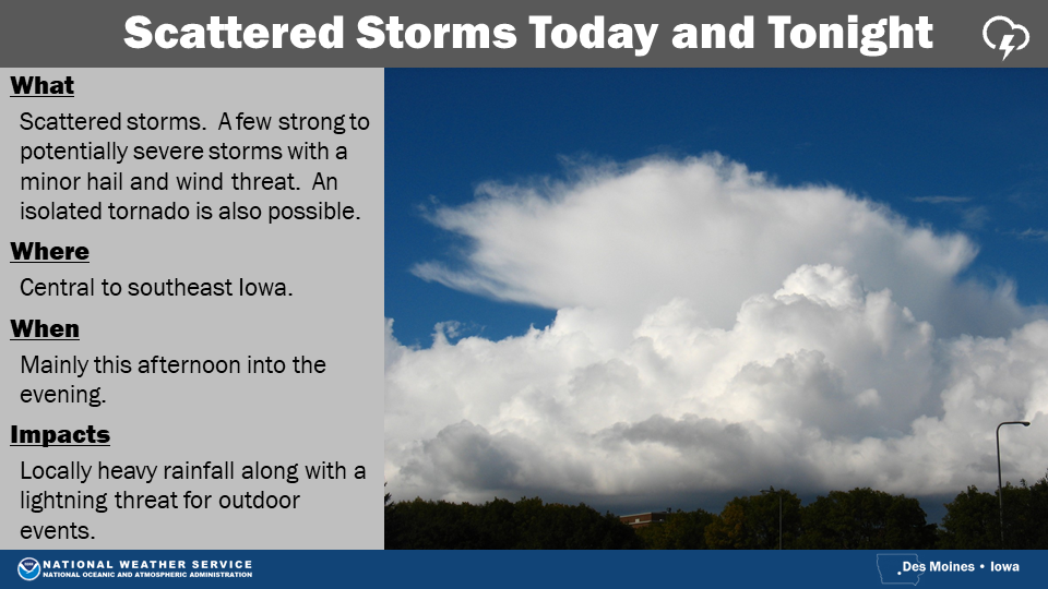
The National Weather Service in Des Moines, says “While a few showers and storms are expected this morning, better coverage is forecast by this afternoon and evening as a cold front passes through the state. A few strong to potentially severe storms are possible by later today with the main concerns from hail approaching 1 inch in diameter and strong gusty winds. An isolated tornado is also possible. Locally heavy rainfall and frequent lightning will also accompany the storms.
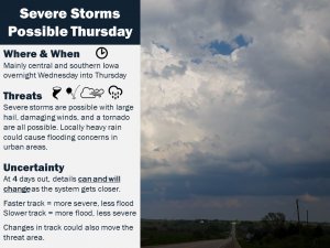
 Storms will move into western Iowa very late Wednesday night and continue through the rest of the state on Thursday. The threat of severe weather continues across the southern half of the state with hail and damaging winds the main concern. An isolated tornado remains possible as well. Locally heavy rainfall could also cause flooding in urban areas. This is still a few days out and details may change, so stay tuned for updates as the forecast is fine tuned.”