
Monona-Harrison-Shelby-Pottawattamie-Mills-Montgomery-Fremont-
Page Counties:
Unseasonably warm temperatures and dry conditions will result in elevated fire weather concern today across much of the area. Relative humidity this afternoon will fall to around 20 percent in southeast Nebraska and southwest Iowa with southwest winds 10 to 20 mph. A cold front will move into northeast Nebraska during the afternoon with humidity there between 25 and 30 percent and northwest winds 10 to 20 mph.
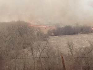
File photo (area field fire March 2014)
Outdoor burning is discouraged due to the increased fire danger today. Use extra caution if using motorized vehicles in grassy areas and handle the disposal of smoking material with care.
Today: Partly cloudy. High 72. SW @ 10-20.
Tonight: P/Cldy. Low 34. NW @ 5.
Tomorrow: P/Cldy. High 63. Winds variable @ 5-10.
Sunday: P/Cldy to cldy. High around 65.
Monday: Mo. Cldy w/light rain. High near 60.
Thursday’s High in Atlantic of 64 degrees broke the record High of 62 set in 1921 & 1961. Our 24-hour Low was 29. Last year on this date, our High in Atlantic was 41 and the low was 29. The Record High in Atlantic on this date was 67 in 1981. The Record Low was -34 in 1958.
Today: Partly cloudy. High 63. SW @ 10-20.
Tonight: P/Cldy. Low 36. SW @ 5-10.
Tomorrow: P/Cldy. High near 70. SW @ 10-20.
Saturday: P/Cldy. High around 60.
Sunday: P/Cldy to Cldy. High near 60.
Wednesday’s High in Atlantic was 47. Our Low was 25. Last year on this date, our High in Atlantic was 34 and the low was 29. The Record High in Atlantic on this date was 62 in 1921 & 1961. The Record Low was -33 in 1958.
Today: Partly cloudy. High 50. NW-W @ 10-15.
Tonight: Fair to P/Cldy. Low 30. SW @ 5-10.
Tomorrow: P/Cldy. High 63. SW @ 10-20.
Friday: P/Cldy. High 68.
Saturday: P/Cldy. High near 60.
Tuesday’s High in Atlantic was 49. Our Low this morning was 25. Last year on this date, our High in Atlantic was 45 and the low was 28. The Record High in Atlantic on this date was 72 in 1921. The Record Low was -31 in 1905.
Today: Partly cloudy. High 48. NW @ 10-20.
Tonight: Mostly clear. Low 21.
Tomorrow: Mostly Sunny. High 48. W @ 10.
Thursday: P/Cldy. High near 60.
Friday: P/Cldy. High 65.
Monday’s High in Atlantic was 49. Our Low this morning was 23.Last year on this date, our High in Atlantic was 31 and the low was 17. The Record High in Atlantic on this date was 68 in 1934. The Record Low was -20 in 1936.
We’re all impacted by the weather, one way or another, but Iowans who have a keen interest in the actions of Mother Nature should consider becoming an official spotter. Kelsey Angle, the warning coordination meteorologist at the National Weather Service, says spotter training classes start next week at locations all across the state. “Storm spotter training is training people to identify when severe weather does occur and then how to report that information to the National Weather Service,” Angle says. “These people are extremely important in the verification process in regards to severe weather and also putting that information into the warnings and statements that we distribute to the public.” 
Over the years, more than 45-hundred weather spotters have been trained in central Iowa alone and Angle says they’re an exceptionally valuable resource. “The training is free and open to the public,” Angle says. “Participants will go through an hour-and-a-half of training which will include identification of tornadoes, how to measure hail, as well as describe wind damage and how to report that information back to the National Weather Service.”
Sometimes, young people become especially fascinated by the weather and they can make excellent spotters — for life. “There is no age limit associated with the training,” Angle says. “Anybody that has an interest in weather and reporting information to the National Weather Service is welcome to attend.”
Even if you’ve gone through the training before, he suggests taking the course every year as a refresher. Thirty-three spotter training sessions are planned just in central Iowa through April, with the first course scheduled for February 21st in Webster County.
Locally, Storm Spotter Training classes are being offered:
(Radio Iowa)
Today: Partly sunny. High 54. W/SW @ 10-15.
Tonight: Partly cloudy. Low 28. NW @ 5-10.
Tomorrow: Mostly Sunny. High 48. N @ 10-15.
Tuesday: P/Cldy. High 46.
Wednesday: P/Cldy. High 58.
Sunday’s High in Atlantic was 47. Our Low this morning was 21.Last year on this date, our High in Atlantic was 17 and the low was 4. The Record High in Atlantic on this date was 63 in 1934. The Record Low was -30 in 1905.
After the massive Missouri River flooding of 2011, plans were made to install a better system for monitoring heavy rain and run-off from snowpack to more accurately predict pending floods. Jody Farhat, Omaha division chief of the U-S Army Corps of Engineers, says a better, real-time reporting system was designed — but still hasn’t been built.
“There was authorization in 2014 to install a monitoring system for those aspects, the soil moisture and the snowpack,” Farhat says. “That has not been funded at this time but we’re hoping to get started on the process this year.” Farhat says other improvements have been made to the reporting system in the past six years. “We are working much more closely with the states and we also have set up a network of observers to give us snowpack measurements during the winter,” Farhat says. “We are getting better information this year that’s being fed into the NOAA products. I do think we have a better handle on it than we did in 2011.”
Farhat says despite above-normal snowpack this winter, it doesn’t compare to that of 2011. “Even though we have an area of high plains snowpack right now in North Dakota and in north-central South Dakota, it’s smaller in area and extent than it was in 2011 at the peak and it peaked in late February in 2011. Also, the mountain snowpack is tracking pretty close to normal.”
The Corps is predicting above-normal run-off into the Missouri River reservoir system for February through April. Farhat says they have “adequate” flood storage available behind the six mainstream dams.
(Radio Iowa)
Early This Morning: Clear. Southwest wind near 5 mph.
Today: Sunny. High in the lower 50s. Southwest wind 5 to 15 mph with gusts to around 25 mph.
Tonight: Mostly clear. Low in the upper 20s. West wind 5 to 10 mph.
Tuesday: Sunny. High in the upper 40s. Northwest wind 5 to 15 mph with gusts to around 25 mph.
Wednesday: Sunny. High in the lower 40s. Northwest wind 5 to 10 mph.
Thursday: Sunny, warmer. High in the mid 50s.
Today: Sunny, with a high near 44. Breezy, with a northwest wind 10 to 20 mph, with gusts as high as 30 mph.
Tonight: Mostly clear, with a low around 22. Northwest wind 5 to 10 mph becoming calm in the evening.
Monday: Mostly sunny, with a high near 47. Light south southwest wind becoming southwest 5 to 15 mph in the morning. Winds could gust as high as 20 mph.
Monday Night: Partly cloudy, with a low around 25. Southwest wind around 10 mph becoming west northwest after midnight.
Tuesday: Sunny, with a high near 46. Northwest wind 10 to 15 mph, with gusts as high as 25 mph.
Tuesday Night: Clear, with a low around 23.
Wednesday: Sunny, with a high near 40.


