
INDIANAPOLIS (AP) — After several quiet years, tornadoes have erupted in the United States over the last two weeks as a volatile mix of warm, moist air from the Southeast and persistent cold from the Rockies clashed and stalled over the Midwest. On Monday, the U.S. tied its current record of 11 consecutive days with at least eight tornadoes confirmed on each of those days, said Patrick Marsh, warning coordination meteorologist for the federal Storm Prediction Center. The previous 11-day stretch of at least eight tornadoes per day ended on June 7, 1980. “We’re getting big counts on a lot of these days and that is certainly unusual,” Marsh said.
The National Weather Service had already received at least 27 more reports of tornadoes Tuesday, suggesting that the record for consecutive days would be broken once the official totals are in. The weather service has received 934 tornado reports so far this year, up from the yearly average of 743 observed tornadoes. More than 500 of those reports came in the last 30 days. The actual number is likely lower, however, because some of the reports probably come from different witnesses who spot the same twister.
The U.S. has experienced a lull in the number of tornadoes since 2012, with tornado counts tracking at or below average each year and meteorologists still working to figure out why. “A lot of people are trying to answer that, but there’s no definitive answer,” Marsh said. The recent surge in tornado activity over the past two weeks was driven by high pressure over the Southeast and an unusually cold trough over the Rockies that forced warm, moist air into the central U.S., sparking repeated severe thunderstorms and periodic tornadoes. “Neither one of these large systems —the high over the Southeast or the trough over the Rockies— are showing signs of moving,” Marsh said. “It’s a little unusual for them to be so entrenched this late in the season.”
Those conditions are ripe for the kind of tornadoes that have swept across the Midwest in the last two weeks, said Cathy Zapotocny, a meteorologist for the weather service in Valley, Nebraska. Zapotocny said the unstable atmosphere helped fuel many of the severe winter storms and subsequent flooding that ravaged Nebraska, Iowa and Missouri earlier this year.
“We’ve been stuck in this pattern since February,” she said. Zapotocny said the number of tornadoes this year was “basically normal” until the surge this week. May is typically the month with the highest incidence of tornadoes, usually in the Plains and Midwestern states collectively known as Tornado Alley, where most of this year’s twisters have hit.
Most of the confirmed tornadoes were rated as less-intense EF0, EF1 and EF2s on the Enhanced Fujita Scale. But 23 were classified as EF3 tornadoes, with wind speeds of 136-165 mph. The strongest confirmed tornado this year was the EF4 tornado that killed 23 people in Alabama in March. So far this year, 38 people have died in 10 tornadoes in the United States, including a combined seven within the last week in Iowa, Missouri, Oklahoma and Ohio. The relative quiet in recent years followed the massive tornado that killed 161 people and injured more than 1,100 in Joplin, Missouri, in 2011. The EF5 storm packed winds in excess of 200 mph and was on the ground for more than 22 miles.
Scientists also say climate change is responsible for more intense and more frequent extreme weather such as storms, droughts, floods and fires, but without extensive study they cannot directly link a single weather event to the changing climate. Monday’s outbreak was unusual because it occurred over a particularly wide geographic area. Eight states were affected by two regional outbreaks, in the high Plains and the Ohio River Valley. Tornadoes strafed the Kansas City metropolitan area straddling Kansas and Missouri Tuesday night, barely a week after a massive tornado ripped through the Missouri state capital of Jefferson City.
(Updated 10-a.m. 5/29) The National Weather Service in Omaha/Valley Nebraska reports Flood Warnings continue for the Missouri in western Iowa and eastern Nebraska. A Flood Warning continues for…
PRECAUTIONARY/PREPAREDNESS ACTIONS…
Do not drive cars through areas where water covers the road. The
water depth may be too great to allow your vehicle to pass safely.
Turn around…don`t drown!
Today: Area of morning fog; P/Cldy to Cldy w/scattered showers & thunderstorms this afternoon. High around 70. N @ 10.
Tonight: P/Cldy to Cloudy w/showers & thunderstorms ending. Low 56. Winds light & variable.
Tomorrow: P/Cldy w/isolated showers & tstrms. High 76. Variable breeze @ 5-10 mph.
Friday: P/Cldy. High around 80.
Saturday: P/Cldy to cloudy w/scattered shwrs & tstrms. High around 78.
Yesterday’s High in Atlantic was 65. Our Low 54. Rainfall in Atlantic from 7-a.m. Tuesday thru 6-a.m. today amounted to .21″ (for a total of 1.99″). Last year on this date our High was 92 and the Low was 65. The record High in Atlantic on this date was 104 in 1934. The Record Low was 29 in 1947.
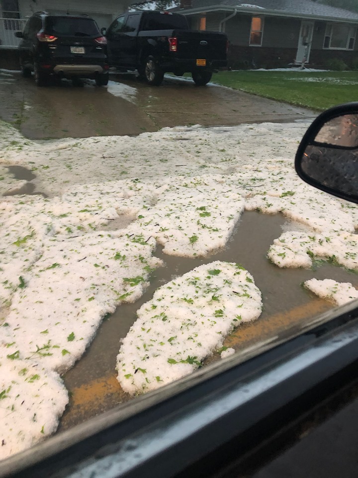
OMAHA, Neb. (AP) — Strong thunderstorms that raked eastern Nebraska and western Iowa dumped heavy rain and, in southwest Omaha, piles of hail that left some motorists temporarily stranded. Western Nebraska was first to endure the storms Monday night, with hail larger than 2 inches in diameter reported west of Ogallala. The Omaha World-Herald reported dozens of cars pulled off Interstate 80 with broken windshields. North Platte also received reports of baseball-sized hail.
Hail was reported to have been at least 12-inches deep in parts of Omaha and Council Bluffs. Snowplows were used to clear the streets of hail in those cites, and in Adair this (Tuesday) morning, as well. In Council Bluffs, a number of streets flooded as more than 2 inches of rain fell there overnight. Flash flood warnings were issued there and for areas around Lincoln and Omaha.

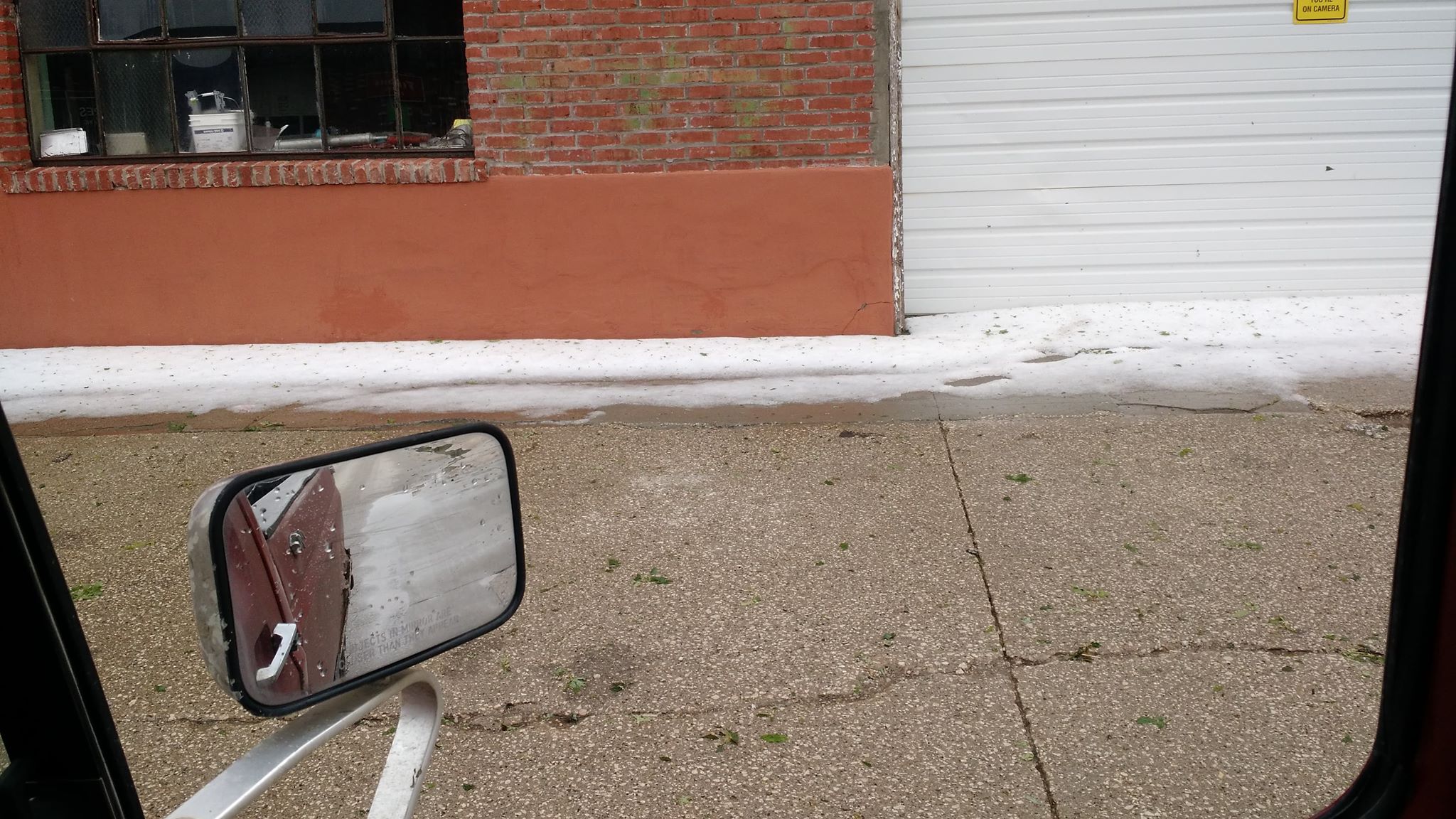
Hail in Adair (Photos courtesy David W. Passehl)
(Radio Iowa) — At least five tornadoes touched down in Iowa yesterday (Monday). “Kind of the strange part about this type of weather was it wasn’t even really associated with true thunderstorms, so a little bit of a rarity.” Meteorologist Todd Shea works in the National Weather Service office in La Crosse, Wisconsin, which tracked some of Monday’s storms. “Most of the tornadoes that did occur from Charles City up towards Lime Springs and into southern Minnesota literally occurred with storms that weren’t even considered thunderstorms. There wasn’t even thunder or anything. It was just rain showers, but it was an environment that could support that type of tornado activity.”
The National Weather Service has confirmed 52 tornadoes in eight states yesterday. Two “sizable” tornado tracks have been established in northeast Iowa. “Most of the damage was to farm buildings. There were a couple of homes near Charles City that were hit pretty hard,” Shea says. “But a lot of the tornado activity also just occurred in open country which was kind of a blessing, that it didn’t hit more structures.”
One tornado early Monday afternoon caused heavy damage to the Floyd County Fairgrounds in Charles City, as well as to a fertilizer plant. There was also tornado damage in or near Lime Springs, Elma, Cantril and in southeast Iowa’s Des Moines County. Howard County Emergency Management Coordinator Darrell Knecht (kun-NEKT, like “connect”) says the roofs were damaged in several homes near Riceville and Saratoga and a hog confinement was destroyed.
“One of the wind turbines had several of the blades on their propellers torn off and then the tornado continued on toward Lime Springs. went over the top of Lime Springs and just did tree and power line damage there,” he says. “And of course there was a lot of tree and power line damage out in the rural areas as well.” A sixth twister is still unconfirmed near the Quad Cities. No serious injuries are reported.
The National Weather Service in Des Moines reports a significant severe weather threat exists this afternoon, with all severe hazards possible including tornadoes, large hail, damaging and flash flooding. Remain weather aware today and be ready to take action! 
Severe storms battered western and southwest Iowa this morning with winds in excess of 60-mph and large hail. Here are some recent reports from the National Weather Service:
10:38-a.m. 3 miles S/SE of Thayer in Union County: 1.7″ of rain.
8:01-a.m. 1″ diameter hail 2 miles SW of Tingley in Ringgold County
7:00-a.m. Bedford: 2.74″ of rain
7:30-a.m. 4 miles S/SW of Brayton: 1.63″ of rain.
6:48-a.m. estimated 60-mph wind gust 3 miles E/SE of Dexter in Madison County
6:40-a.m. 6-to 8-inch tree branches down in Menlo, winds estimated at 70-mph
6:37-a.m. 10-to 12-inch diameter tree limbs blocking roads in Stuart
6:33-a.m. 5 miles W/NW of Gravity in Taylor County: large tree down at the intersection of Franklin Ave, & 175th Street, NW of Bedford.
6:29-a.m. 1-inch diameter hail 5 miles N. of New Market, in Taylor County.
6:23-a.m. 62-mph wind gust recorded on a home weather station 5 miles NW of Creston
6:22-a.m. 10-to 12-inch diameter tree branches down in Casey
6:20-a.m. Tree limbs down in Clarinda, some landed on power lines
6:19-a.m. 61-mph wind gust recorded on a home weather station 3-miles w. of Anita
Pottawattamie IA-Sarpy NE-Douglas NE-Saunders NE-Cass NE-
707 AM CDT Tue May 28 2019
The National Weather Service in Omaha has issued a Flood Warning for Urban Areas and Small Streams in Pottawattamie County in southwestern Iowa…
Northern Sarpy County in east central Nebraska…
Douglas County in east central Nebraska…
Saunders County in east central Nebraska…
Northwestern Cass County in southeastern Nebraska…
* Until noon CDT.
* At 703 AM CDT, Doppler radar rain estimates and automated rain gauges indicated heavy rain had caused flooding from Saunders County west of the Omaha Metro, through Omaha, and across much of Pottawattamie County Iowa. The heaviest rain has ended but flooding continues along roadways, with rises in area creeks on-going. Up to two inches of rain have already fallen.
This includes the following highways…
Interstate 29 between mile markers 43 and 63.
Interstate 80 in Iowa between mile markers 1 and 23, and near mile marker 48.
Interstate 80 in Nebraska near mile marker 426, and between mile markers 443 and 454.
PRECAUTIONARY/PREPAREDNESS ACTIONS…
Turn around, don`t drown when encountering flooded roads. Most flood
deaths occur in vehicles.
(Radio Iowa) — Iowa has fallen from the 9th to the 12th most expensive state for hail damage, according to an annual survey from the state’s largest home and auto insurer. Andrew Peschong, a State Farm agent based in the Des Moines area, says Colorado, Texas and Illinois had the worst hail damage last year, but it shifts around, depending on where the most severe weather strikes. “In 2017, we had $132-million in hail claims alone with State Farm just in Iowa,” Peschong says. “In 2018, that number went down to $57-million, so while there still was quite a few hail events in Iowa in 2018, it was down from the previous year.”
Last year, Iowa customers reported nearly six-thousand hail claims, with the average homeowner claim topping 13-thousand dollars and more than 34-hundred dollars for cars. It may not seem like hail storms hit Iowa that frequently, but Peschong notes, they don’t have to last long to do a lot of damage. “All it takes is 10 seconds or 20 seconds worth of hail falling and you have a large percentage of a certain neighborhood that will all have claims,” Peschong says.
While nothing can be done to prevent a hail storm, you can prevent problems associated with them by doing some good tree pruning every year. Also, when building or remodeling, he suggests you consider your roofing carefully. “If you’re going to get an impact-resistant roof or an impact-resistant shingle, you will pay a little more for it,” Peschong says, “but on the back end, it will really help a lot when you come into a hail storm, preventing that damage.”
He also advises clients to do a home inventory by taking pictures or video and store that inventory digitally. In addition, he says to talk to your agent and ask about your coverage and deductible.


