


Ice jams and flooding threat exists for mid-to late this week
March 11th, 2019 by Ric Hanson
Click to enlarge image

Click to enlarge image
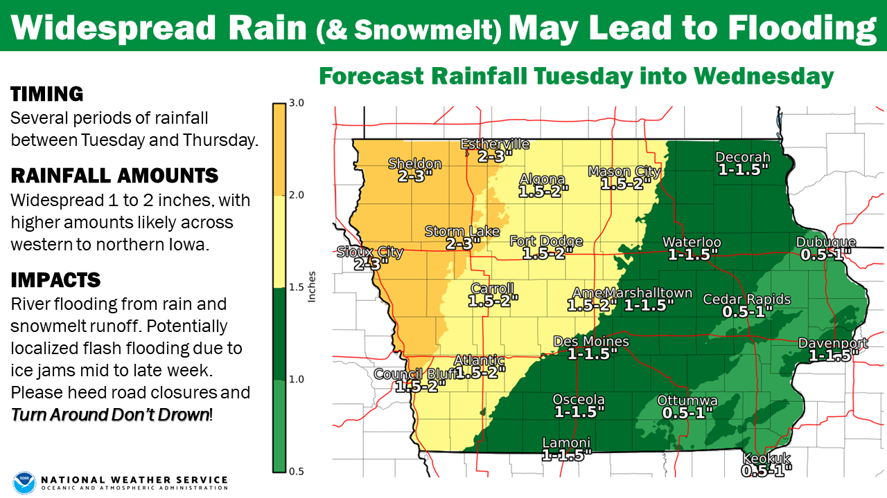
The National Weather Service reports widespread rain across Iowa remains on track for Tuesday through Thursday, where a swath of 1 to 2 inches of rain can be expected. Thunderstorms are possible as well, resulting in locally higher amounts approaching 3 inches, especially over western portions of Iowa. In addition to the rainfall, warmer temperatures will melt a good portion of the snow pack today through Wednesday resulting in significant runoff and potential river flooding mid to late week and into the weekend. The potential for ice jams exist as the runoff, swelling rivers, and warmer temperatures look to break up the river ice and lead to some localized flash flooding.

