712 Digital Group - top

Wind chills Sunday morning (3/3) will be dangerously cold

News, Weather

February 25th, 2019 by Ric Hanson

The National Weather Service is calling this Winter season “Relentless,” especially when it comes to expected Wind Chill temperatures. Tuesday morning, wind chills across southern Iowa will range from -5 to -15 degrees, with -20 to -30 expected roughly north of Highway 30. By Sunday morning, the Wind Chill Index  (https://www.weather.gov/bou/windchill), or, how cold it feels with the air temperature and wind factored-in, is expected to be in the -27 degree range from I-80 south, to the lower to mid-minus 30 degree range from I-80 north all the way to northern Iowa, with -35 expected for Estherville and Mason City.

The wind chill index takes into account heat loss from the human body to its surroundings during cold and windy weather. Wind chill values near minus 25 degrees mean that frostbite is possible within 15 minutes.

Frostbite is the freezing of skin and the body tissue just beneath it. It first affects exposed body tissue where blood circulation may be limited such as your fingers, toes, nose and ears. To minimize frostbite, make sure all body parts are well covered. When frostbite starts, feeling is lost in the affected area and the frozen tissue will take on a white or pale appearance. If you suspect you are experiencing frostbite, hold the frostbitten area closely against warm skin to return blood flow and warmth to the affected area.
Hypothermia is a dangerously low body temperature and is the most common winter weather killer. When you hear of a hiker, climber, hunter, or a stranded traveler perishing from cold weather exposure, hypothermia was the cause. Most people are surprised to learn that hypothermia deaths can occur with temperatures between 30 and 50 degrees. If you or tour clothing are wet, then hypothermia becomes even more likely.

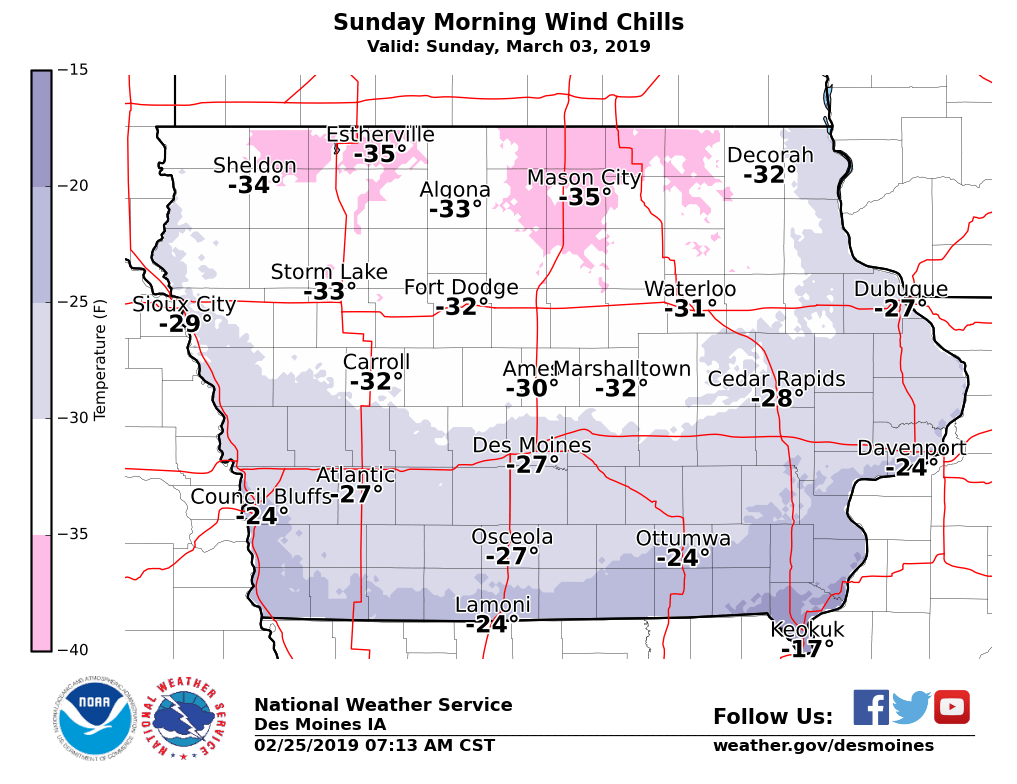
Projected Wind Chill readings Sunday, March 3rd