


Mixed bag of precip. likely beginning Friday night
February 21st, 2019 by Ric Hanson
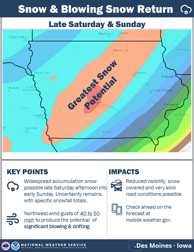
The National Weather Service, in it’s update this (Thursday) morning, said “An unsettled weekend ahead as yet another strong storm system impacts the region. A wintry mix will be possible Friday night and Saturday morning across all of central IA. On Saturday, temperatures warm enough for precipitation to transition to rain, with even some elevated flood potential especially across southern IA. Falling temperatures will turn rain to snow late Saturday with snow accumulations likely. Area of greatest snowfall potential bisects Iowa from northeast to southwest. Increasing northwest winds will gust to 40-50 mph Saturday night and Sunday producing the potential for considerable blowing and drifting snow.”
Officials say forecast uncertainty remains as far as the track and strength of this storm system. So those with travel plans this weekend will want to check back over the coming days as the forecast is refined.

Click on the graphic to enlarge

