Severe weather possible this evening and tonight
September 20th, 2018 by Ric Hanson
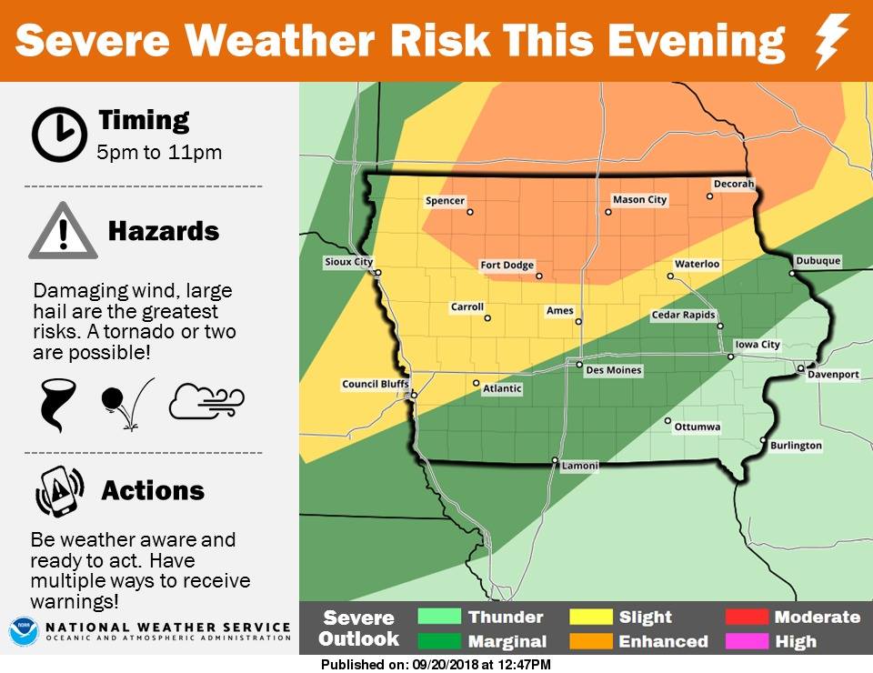
A line of showers and thunderstorms is expected to move from northwest to southeast across the area late this afternoon into tonight. Storms are expected to develop around 4-5pm across far northwest Iowa. Storms will move rapidly to the southeast with the peak impacts between 6pm and 11pm. Damaging winds, large hail and frequent lightning are the primary concerns. A tornado or two is also possible, although the higher tornado risk has shifted north into Minnesota. While a brief period of heavy rainfall is possible as the storms move through, the faster movement of storms should limit the flash flood threat. The greatest threat for severe weather is over the northern third of Iowa, with areas from Atlantic to Council Bluffs northward, to Carroll and east to Ames under a slight risk.