


Snowfall amounts may be changing in western Iowa
December 28th, 2015 by Ric Hanson
In its mid-morning update, the National Weather Service says a major winter storm remains on track to impact much of Iowa today and tonight. The storm track has shifted a bit east, though, and as a result the greatest expected snowfall amounts have also shifted east a bit. In western and southwest Iowa, the Weather Service predicts anywhere from 4-to 7-inches is possible, with Guthrie County and points north and slightly northwest receiving 6- to 10-inches of snow.
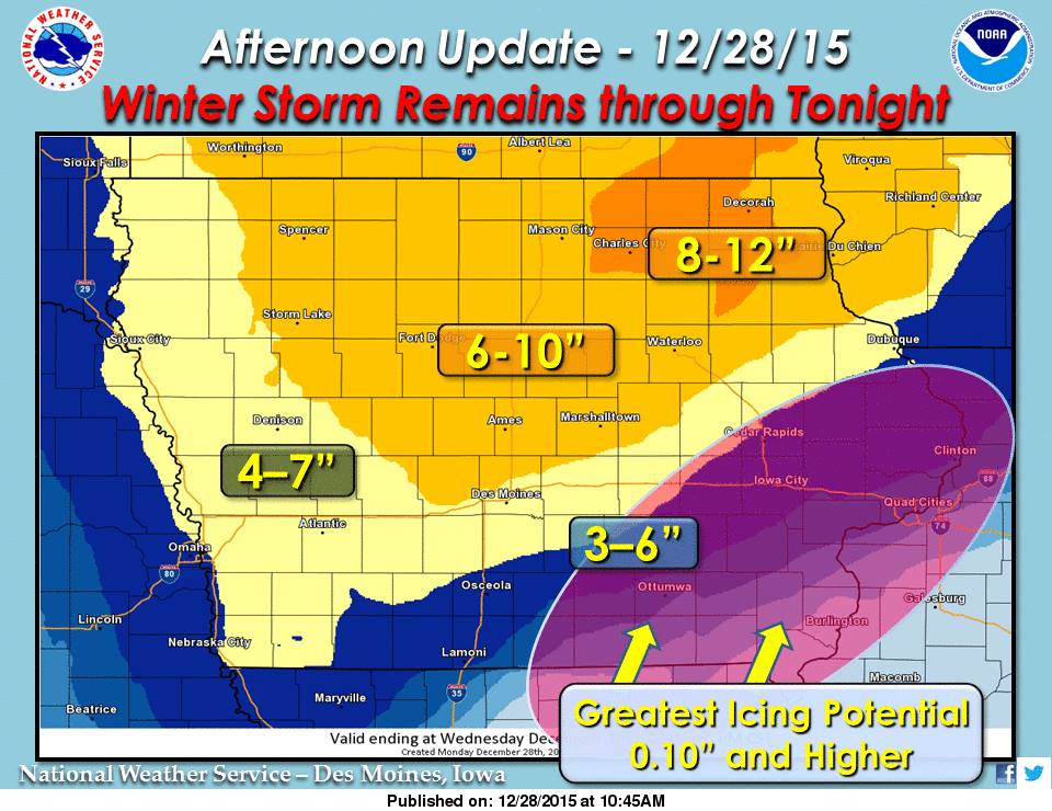 As much as 12″ of snow or more is possible across northeast Iowa, while much of northern and portions of central Iowa may see 6-10″ of snow through tonight. The combination of strong winds and heavy snow (snowfall rates of 1″ per hour at times) is expected to cause blowing snow over central and northwest Iowa. A wintry mix of freezing rain, sleet and snow remains in the forecast for southeast Iowa. With the potential for significant icing over areas such as Ottumwa and northeast towards the Quad Cities, where as much as a half inch or more of ice is possible. Damage to power lines and trees will be possible as well, especially with additional force from expected high winds.
Travel conditions will continue to be treacherous at times, especially as another round of moderate to heavy precipitation is expected to arrive by mid-afternoon. Do not travel unless absolutely necessary today. Click here for the latest briefing and forecast information: http://www.weather.gov/dmx/dssforecast

