


Get ready for another see-saw style weather week
July 1st, 2014 by Ric Hanson
After a warm and humid week across Iowa, near-record cold temperatures are slated to move into Iowa for the next few days. The National Weather Service in Des Moines says non-severe, scattered storms are possible mainly north of I-80 this afternoon. Rainfall amounts with these storms should be on the very light side, with totals remaining less than one tenth of an inch. Mostly cloudy skies should help keep temperatures in the 60s and 70s across the area today.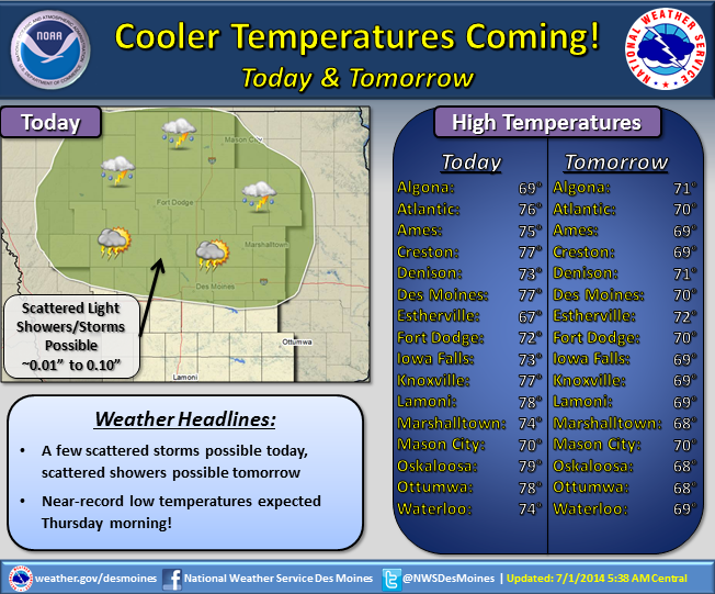
Cooler air will continue to move into the region tomorrow, as highs will be confined to the upper 60s and low 70s. For Thursday morning, the record low in Atlantic is 43 degrees. As of now, it appear the temperature Wednesday night into early Thursday morning we will be very close to that number.
Warmer air and storm chances will return to Iowa for this July 4th weekend, so if you do have outdoor plans Saturday into Monday, make sure to monitor the weather forecast each day, beginning with today.
