


A dangerous weather situation could unfold late this afternoon/evening
October 4th, 2013 by Ric Hanson
The Iowa Storm Chasing Network says a “Very dangerous situation” could be in the works for this afternoon and this evening, where the development of destructive tornadoes is concerned. The enhanced risk exists over a large portion of Iowa.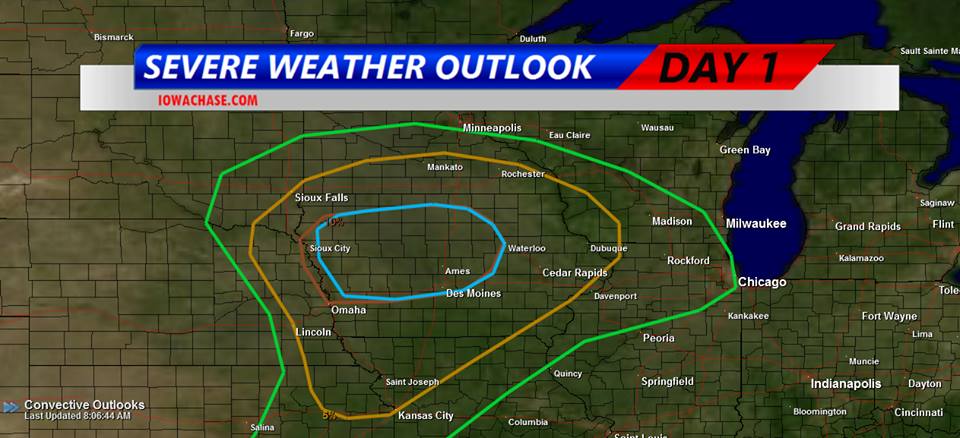
Thunder and lightning awakened many Iowans this morning (Friday) as a potent, large storm system began to bear down on the state. Numerous thunderstorm watches and warnings were issued in the wee hours. Meteorologist Brad Small, at the National Weather Service, says the next several hours will be an active period for weather across much of the state. “The potential is still there for more activity later in the day,” Small says. “There’s a moderate risk of severe weather over northern Iowa and into parts of central Iowa. That would mean all kinds of severe weather, large hail, damaging winds and tornadoes are all possible in that area.” To the west, Small says it’s much less like early fall and much more like the dead of winter as Blizzard Warnings and Winter Storm Watches are in effect in South Dakota, Nebraska, Colorado and Wyoming.
“There’s heavy snow in the Black Hills, thankfully we’ll miss out on that but temperatures will be sharply colder by tomorrow,” Small says. “It’s a big change from what we’ve seen the past few days. Highs will only be in the 50s and 60s.” Iowans can count their blessings as some states to the west have a forecast that includes 12 to 20-inches of snow and strong winds, bringing white-out conditions.
(Radio Iowa/Iowa Storm Chasers Network)

