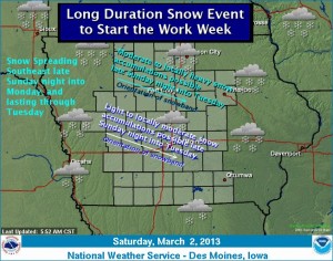
NWS: Long duration snow event to start the work week
March 2nd, 2013 by Ric Hanson
An upper level area of low pressure is forecast to push across the Northern Plains through the weekend and enter the Midwest by late Sunday night. The low will continue to track eastward throughout the day Monday and clear the area by Tuesday. Snow is forecast to develop late Sunday night in northwest Iowa and spread south and east during the day Monday. Snow is likely to continue, especially across northern Iowa Monday night into Tuesday. Moderate to locally heavy snowfall is possible across northern Iowa late Sunday night through Tuesday and lighter amounts are forecast further south. However, uncertainties still remain with the exact track of the low pressure and may lead to a significant change in the location of the heaviest snow. An upper level ridge of high pressure is expected to build into the Central U.S. by mid week and will provide a gradual warming trend beginning Thursday.


